• Home
  • About
  • Contact me
  • Social Housing as Heritage
  • The map of the blog
  • Mapping Pre-First World War Council Housing

Municipal Dreams

Municipal Dreams

Tag Archives: 1930s

A Housing History of Barrow-in-Furness, part II from 1918: ‘Ours must be a slumless city’

12 Tuesday Jan 2021

Posted by Municipal Dreams in Housing

≈ 2 Comments

Tags

1920s, 1930s, 1940s, 1950s, 1960s, 1970s

We left Barrow last week just as its first public housing was under construction. These were homes – though not all justified the term – built by the Ministry of Munitions to house Barrow’s huge armaments workforce just as, it turned out, the First World War was drawing to its bloody conclusion.  In 1917, the town’s Medical Officer of Health (echoing the Council’s official line), had argued that ‘the only solution for gross overcrowding is a scheme for the provision of houses carried out by the Ministry of Munitions’.  By April 1918, the Council’s Health Committee had concluded that ‘it is the duty of local authorities to carry through a programme of housing for the working classes’. Much had changed and this post will deal largely with the council housebuilding programme that ensued, albeit in faltering fashion. (1)

Firstly, however, there was the problem of the two Ministry of Munitions schemes launched in October 1917.  The Roosegate development of semi-permanent housing was built by the Ministry itself; 200 bungalows (of the 500 originally projected) were completed in 1918 – to almost universal obloquy. As one Barrow resident recalled, ‘they were one-roomed and two-roomed houses. It was just simply a box with a lid on’. Locals called the scheme ‘China Town’. In June 1920, the Health Committee warned of the ‘intolerable condition’ of its streets; by March the next year, the Committee described the housing as a ‘a threat to the health of residents’. Its closure was announced in July 1925. (2)

Holcroft Hill, Abbotsmead Estate

The second Ministry scheme at Abbotsmead comprised permanent housing, built by the Council under Ministry contract to designs provided by the latter.  The estate’s layout was better though the houses themselves were criticised for their small rooms and poor build quality.  A bigger problem was the proposed rent levels, initially set at an exorbitant 17s a week (85p) by the Ministry with the Council considering even reduced rents of 10-12s (50-60p) too high. The scheme was abandoned by war’s end with around half of the proposed 500 houses completed. Hopes that the Council might purchase the homes in peacetime were thwarted by cost; most by the mid-1920s had been sold to sitting tenants.

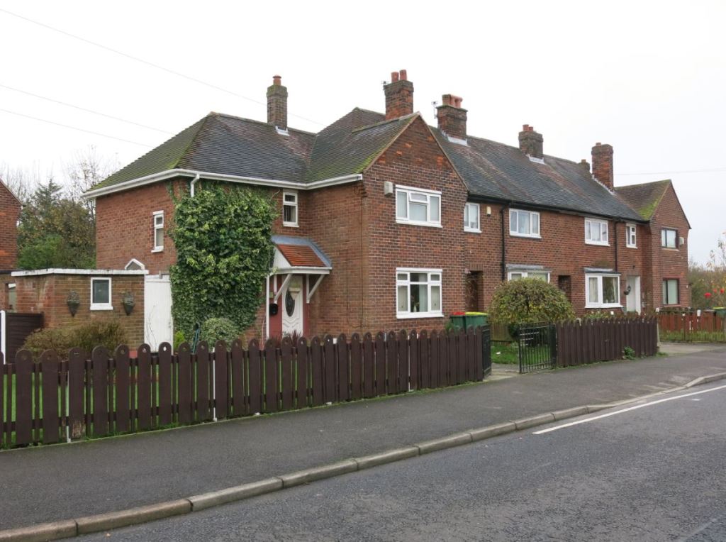
Romney Road, Devonshire Estate

Despite acknowledging in March 1919 that ‘the provision of housing [was] one of its most pressing needs’ and despite the combination of generosity and compulsion offered by the 1919 Housing Act, the Council was slow to respond.  However, belatedly in April 1920, it agreed proposals to build in 113 homes on Devonshire Road and 44 on Walney Island. Both schemes were largely completed in 1921.  

Local as well as national politics had shifted. Labour gained its first majority on the Council in 1920 and would govern again between 1928 and 1931 and 1934 to 1938.  An average turnout of 69 percent through the interwar period, peaking at 81 percent in 1925, shows how fiercely contested these municipal elections were. (3)

However, through much of this period, economics loomed larger than politics. With military orders withdrawn and facing unprecedentedly harsh international trading conditions, Barrow’s traditional industrial mainstays were decimated. By 1922, 60 percent of its shipbuilding workforce and half of its engineering workers were unemployed – 44 percent of its insured workforce overall. Vickers’ workforce fell from 23,000 in July 1918 to a low point of just over 3700 in 1923.  Wage cuts forced a bitter engineering strike in the town in May 1922.

The new housing crisis was manifest in rent arrears and evictions, the latter sometimes fiercely contested as when 20 police officers were sent with bailiffs to enforce evictions in Vickerstown (where 800 tenants had been laid off and rent arrears approached £7000) in February 1922. In the 1920s, the Council’s preoccupation lay with collecting rents – reduced in 1924 from the already low levels of 7s 6s to 5s (37½ to 25p) weekly – rather than building anew.
A second major slump hit Barrow with the onset of the Great Depression in 1929 when at peak in 1931 some 7500 of the locally insured workforce was jobless. There was little female employment in the town to offset mass male unemployment. Rearmament in the later 1930s would restore the town’s fortunes whilst other of its former large employers in railway and locomotive building and metal founding closed permanently.

Flats on Thrums Street, Roosegate Estate

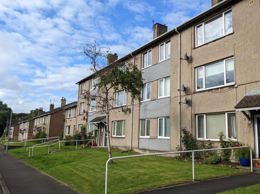
The Labour-controlled Council was able to commence one small building scheme in 1931 on land purchased from the Ministry of Munitions’ failed Roosegate development: 56 flats for elderly people on Thrums Street, followed by an adjacent scheme of 116 semi-detached houses finally completed in 1948.

The national shift towards slum clearance signified by the 1930 Housing Act and, in Barrow’s case more particularly, the 1935 Housing Act provided greater scope for the Council. Some 6384 homes were inspected under the surveys required by the latter legislation and just over half found ‘not in all respects fit for human habitation’ between 1935 and 1937. Applying overcrowding criteria, 887 homes accommodating 5475 persons were found overcrowded in 1937, equating to 6 percent of the town’s housing stock. Twenty-seven clearance areas were declared.
Barrow also suffered unusually from what might be kindly called ‘informal housing’ – shacks and tents predominantly on Walney Island’s western shore.  Some of these were occupied by young people evading the household income provisions of the means test and the Council proceeded cautiously but 28 huts at Biggar Bank on Walney Island were cleared by 1939.

The biggest scalp, however, were the Scotch Flats in Hindpool discussed in last week’s post – tenement buildings dating to 1871 which were among the first of Barrow’s company housing. After two public enquiries, the Ministry of Health agreed the inspector’s decision to demolish in 1939 though – with war intervening – they were to survive till 1956.

Brook Street, Risedale Estate

From a low point of some 66,000 in 1931, Barrow’s population had increased to around 75,000 by 1940. Population pressures and increased finances encouraged the Council to embark on larger building projects in the later 1930s. The Risedale Estate was commenced in 1936; its 148 new homes were completed in 1948.

Vulcan Road, the Vulcan Estate

The Vulcan Estate, built on the site of the former Vulcan Ironworks in Salthouse, was built between 1936 and 1937 as a slum clearance estate to house those displaced from the Strand Clearance Area. Its relatively plain housing may reflect those origins.

Mardale Grove, Greengate South

Land a short distance to the north was purchased for the Greengate Estate, North and South, in 1937 but, with contracts for 180 houses and 54 flats not agreed till the summer of 1939, little progress was made before the war – just 18 houses in Greengate South were completed by February 1940.

The Barrow Blitz: Exmouth Street, May 1941

Some of those were damaged in the Barrow Blitz, two sustained bombing raids on 14-16 April and 3-10 May 1941. Ironically, the town’s heavy industry was relatively unaffected but some 83 civilians died and over 10,000 homes damaged. In Barrow, as elsewhere, the desire to build bigger and better in the post-war world was expressed as conflict raged.

Unsurprisingly, the Ministry of Health rejected immediate plans for rebuilding proposed by the Council as early as 1943 but the Borough Surveyor prepared further plans for Greengate South and a new estate of 900 homes in Newbarns – part of a vision announced by the mayor, Councillor GD Haswell, in November that year to create a ‘new post-war Barrow’.  The Newbarns scheme was approved in May 1944.

The Council’s Barrow Development Committee, tasked with overseeing peacetime reconstruction, was clear on the ‘paramount necessity of suitably housing our people’:

The social benefits to health, education, family life and ‘moral well-being’ are of course ample justification for the provision of houses adequate in number, properly designed and located with ample accommodation. But even from an economic point of view ample and suitable accommodation is a valuable asset. The fact that we have the necessary labour to offer is enhanced in value greatly if we can show it is properly and suitably housed. Ours must be a slumless city.

As that ambition took shape, the town was allocated 400 temporary prefabs to help meet the immediate housing crisis in November 1944. Many of these Tarran concrete bungalows were erected in Tummerhill on Walney Island, replaced from 1956 by permanent housing; others dotted around the town survived longer. Permanent prefabs – in this case around 200 steel-framed British Iron and Steel Federation houses – were built by Laings on Park Road, and north of Chester Street and Bradford Street on the Ormsgill Estate. They were replaced in the mid-1970s as the estate continued to grow.

Middle Field, Ormsgill Estate
Chester Place, Ormsgill Estate

Earlier plans for the Greengate estates were completed in the late 1940s but Barrow’s new hopes were placed in the Newbarns Estate, planned to comprise some 800 homes housing around 3000. Post-war planning ideas around ‘neighbourhood units’ were reflected in the provision made for new churches, schools and recreation facilities though the promised tennis courts and recreation centre were never built.

Kendal Croft, Newbarns Estate
Middle Hill, Newbarns Estate

Building continued apace with the Abbotsmead Estate completed in the mid-1950s and what was promoted as ‘a new town at Walney’ of over 2700 homes in the north of the island approved in 1953 where building continued into the 1960s.  Some 2600 council homes were built between 1945 and 1961.

Later council housing in the south of Walney Island at Cote Ley Crescent

For Barrow, the era of large-scale council housebuilding was over by the late-1960s; new schemes were smaller and largely infill, including the Cartmel and Grange Crescent flats in the centre of town and bungalows and flats principally for older residents around Cotswold Crescent on the former site of the Griffin Chilled Steel Works. A scheme of 79 houses and flats on and around Exmouth Street in 1985 marked an adaptive return to more traditional terraced forms.

Cartmel Crescent

At peak, in the early 1980s, the Council owned around 5500 homes in the borough. Currently, it owns and manages just over 2500 homes with a much smaller number run by housing associations. Around 10 percent of households live in social rented homes, a surprisingly low figure – below the national average – for a town dubbed the most working-class in England (an admittedly inexact judgement apparently reflecting its prevalence of chip shops, workingmen’s clubs and trade union offices). That may reflect the early tradition of working-class owner occupation referenced last week, the amount of company housing since transferred to private ownership and council housebuilding programmes constrained by economic downturn. (5)

‘The Spirit of Barrow’ by Chris Kelly was unveiled in 2005

The town continues to be marked by its industrial history and the ups and downs of the local economy. Vickers, now BAE Systems (that is a considerable simplification of a complex history), was sustained by nuclear submarine orders into the 1990s but now employs only around 5000 workers from 14,000 in the 1980s.  The pre-pandemic unemployment rate stood at around 4 percent, a fall from recent figures but above the national average. Earlier this year, the town was reported as having suffered the largest population fall of any area in England – around 6.8 percent between 2001 and 2019 to the present figure of around 67,000. (6)

Elsewhere, Barrow is often described as being at the end of the longest cul-de-sac in England due to its location at the tip of the Furness peninsula, 33 miles off the nearest motorway and 33 miles back.  The fact that this ‘western industrial periphery’ had briefly been ‘a major Bessemer iron and steel centre of Europe and the world’ tells you something of its impressive and turbulent economic history. (7)

The view from Walney Bridge

Give Barrow a visit – it has some proud municipal heritage and a unique housing history; it’s a hardworking town working hard to adapt to changing circumstance as it has throughout its lifespan. And that ‘remote’ location is actually pretty special.

Sources

(1) Quoted in Bryn Trescatheric, How Barrow Was Built (Hougenai Press, 1985). Much of the information here and particularly that on later council housing, which is little documented elsewhere, is drawn from this invaluable source by Barrow’s leading historian.

(2) Quotations drawn from Elizabeth Roberts, ‘Working-Class Housing in Barrow and Lancaster 1880-1930’ Transactions of the Historic Society of Lancashire and Cheshire, vol 127, 1978 and Trescatheric, How Barrow Was Built

(3) Sam Davies and Bob Morley, County Borough Elections in England and Wales, 1919-1938: A Comparative Analysis (Routledge, 2016). The unemployment figures which follow are drawn from the same source.

(4) Quoted in Trescatheric, How Barrow Was Built

(5) On the town’s working-class character see Caroline Evans, ‘Barrow, Capital of Blue-Collar Britain’, The Guardian, 5 October 2008

(6) Eleanor Ovens, ‘Barrow named as having biggest population drop in England’, The News, 20 June 2020

(7) The quote is drawn from John Duncan Marshall and John K Walton, The Lake Counties from 1830 to the Mid-Twentieth Century: A Study in Regional Change (Manchester University Press, 1981)

Share this:

  • Twitter
  • Facebook
  • Email
  • More
  • Tumblr
  • LinkedIn
  • Reddit
  • Pinterest

Like this:

Like Loading...

Preston’s Council Housing, Part I to 1939: ‘Compactness, Convenience and Taste’

03 Tuesday Nov 2020

Posted by Municipal Dreams in Housing, Preston

≈ 8 Comments

Tags

1920s, 1930s

In 1709, Preston was described as ‘a very pretty town with abundance of gentry in it; commonly called Proud Preston’.  The gentry may have disappeared and the town (a city since 2002) changed out of all recognition but the appellation has remained. Local pride might be seen now in what has been dubbed the ‘Preston model’ – a form of ‘guerrilla localism’ in the words of Aditya Chakrabortty; a scheme of community wealth building based on plural ownership of the economy, local procurement and socially productive use of land and property. (1)

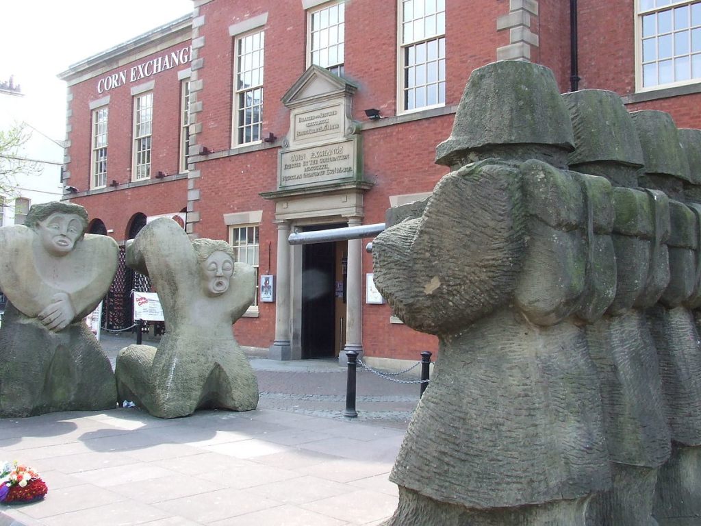
The Preston Martyrs Memorial on Lune Street by Gordon Young, commemorates the four strikers killed in 1842 © Andrew Gritt and made available through a Creative Commons licence

These posts will look at what might be properly understood as an earlier form of community wealth building – the city’s history of council housebuilding.  That history was rooted in a common experience though one writ large in the Lancashire town – industrialisation and urbanisation. Preston’s first cotton mill was opened in 1777; by 1835, there were 40. Working conditions (and Chartism) led to a general strike in 1842 during which four protestors were shot dead by the military. An eight-month lockout and strike in 1853-54, witnessed by Charles Dickens, inspired his famous description of ‘Coketown’ in Hard Times:

a town of red brick or of brick that would have been red if the smoke and ashes had allowed it; but as matters stood it was a town of unnatural red and  black like the painted face of a savage. It was a town of machinery and tall chimneys, out of which interminable serpents of smoke trailed themselves forever and ever and never got uncoiled.

Karl Marx added his own excited commentary: ‘The eyes of the working classes are now fully opened, they begin to cry: Our St. Petersburg is at Preston!’. (2)

A Preston townscape. The lithograph shows unemployed mill hands at work on Preston Moors in 1862 during the ‘Cotton Famine’ caused by the American Civil War

St Petersburg/Petrograd may have come good for Marx in 1917 but Preston’s municipal politics in the interwar period in its first great era of council housebuilding were, as we’ll see, to be far more collaborative and collegiate.

Preston’s population grew from under 12,000 in 1801 to 117,000 in 1920 and its insanitary terraced housing brought cholera outbreaks in 1832 and 1848 and a major typhus epidemic in 1862. Infant mortality rates remained well above the national average – in the early 1890s standing at 235 deaths per thousand against an English average of 151 –  but they fell before the First World War as the Corporation converted privies to water closets at the rate of 1- to 2000 a year. Living standards remained low, however, with the prevalence of female employment (around 30 percent of married women worked in the mills in 1905) having the collateral effect of reducing male wages. (3)

An active housing improvement programme notwithstanding, the council – a county borough since 1881 – had no interest in housebuilding. It remained – despite the election of its first Labour councillor in 1904 – a largely Conservative borough. However, as was typical across the country, the First World War changed much.

Basil Street, Deepdale Estate

This wind of change was illustrated powerfully by the March 1918 Local Government Board circular requesting local authorities to provide detail of ‘definite building schemes’ and numbers of new council homes projected. Preston Borough Council discussed the circular in April, not only forming a Housing Committee but identifying land in Moor Park and Deepdale (near the Preston North End football ground) as suitable for building. It was one of 1300 councils replying by the deadline of December 1918. (4)

Thereafter, progress was slow and more controversial. By February 1919, the Preston Trades and Labour Council (PTLC) was viewing ‘with regret the inaction of the Town Council in the matter of housing’,  Next month, the Housing Committee resigned when its detailed plans for an estate at Holme Slack were rejected by full council which instructed it ‘to advertise and offer prizes for competitive designs’.  In May, the PTLC intervened again, decrying the paucity of council proposals and demanding that ‘at least 50 per cent of direct representatives of labour should be co-opted’ to serve on the now reconstituted Housing Committee.

That proposal was deemed unlawful – the Preston Building Trades Employers’ Association had also expressed their displeasure – but it’s an interesting sign of local politics and national trends that it was agreed in September to co-opt two members of the PTLC alongside one representative of the Preston Property Owners Association. The emphasis on women’s voices on housing in this post-war period (discussed in a recent post) was reflected in the inclusion of one representative of the (Conservative) Preston Women Citizens’ Association and one from the local Women’s Cooperative Guild. (5)

All this before the 1919 Housing Act, overseen by Christopher Addison, received its Royal Assent in July. The housing needs survey required of all local authorities was produced by Preston in October when the Medical Officer of Health reported that 980 local homes were overcrowded, 136 unfit for habitation and 12 areas comprising in total 806 houses justified clearance. Up to 2000 new homes were needed. (6)

By then progress had been made. The government’s regional Housing Commissioner had visited the town in May and plans for estates of around 500 homes each in Holme Slack and Ribbleton had been approved.  At this point the Council was taking an unusually close interest in the fine detail of the proposed housing.

This image of Waldon Street on the Callon Estate shows more recent streetscape improvements made by the City Council

Members of the Housing Committee visited Merseyside for ideas and models as well as the Daily Express Model Homes Exhibition in London. In November 1919, a subcommittee was appointed to ‘consider the construction, materials and equipment of the houses’ and later in the month four pages of detailed written notes were provided covering such minutiae as tarmacked garden paths and concrete clothes posts. (In further testimony to the hands-on approach taken here, handwritten notes in the archives record the names and addresses of new council house tenants.) (7)

The new houses were (as required) cottage homes built to Tudor Walters standards but the Council sought to go further by insisting on 8ft 6in height ceilings, rather than the 8ft recommended. It would compromise on this issue – it was agreed upper-floor ceilings should be 8ft high – under protest. The Council was less successful in insisting on lower rents than those demanded centrally.  Rents of 8s (40p) and 10s (50p) for two- and three-bed non-parlour house respectively were agreed but the Council’s plea that the larger parlour houses were ‘intended to be tenanted by large families with young children’ was rejected and these were let at 12s 6d (62½p) and 15s (75p). (8)

Despite the generous financial terms of the 1919 Act, the expectation was that rents would be ‘economic’ and, with Preston’s new council homes costing between £891 and £976 to build, those rents would be out of reach to many.  The Council, as was typical in this post-war era, prioritised ex-servicemen and their widows in its allocations policy but by 1930, in socio-economic terms, only some 38 percent of Holme Slack heads of households could be classified as manual working class; 30 percent belonged to the non-manual working class whilst 17 percent comprised those in professional, managerial or commercial categories. (9)

Practical problems of materials and labour shortages delayed construction despite the special subcommittee (which included representatives from the Preston Master Builders’ Association and Preston Building Trades Operatives) appointed in May 1920 to overcome supply difficulties and the strong action in November when the Council used its powers under the Housing (Additional Powers) Act to temporarily halt construction of non-essential work on a cinema. (10)

Early council housing on Chestnut Crescent, Ribbleton Estate

The first two houses on the Ribbleton Estate, one opened as a show home, were completed in March 1921. Designed by local architects Messrs JH and W Maugan and reflecting the attention paid by the Council to their design, the local press was suitably complimentary: (11)

The house furnished for the exhibition at once suggests compactness, convenience and taste … [The estate] comprises blocks of two, three and four houses arranged on the garden city plan. There are no continuous and monotonous lines of houses.

A cupboard and glass cabinet in the parlour, linen cupboard and wardrobe in the main bedroom, ‘ample provision in the way of shelves’ as well as the sanitary necessities that would previously have been luxuries to many of the new tenants, all made this high-quality accommodation, ‘tastefully treated’ throughout. (12) 

Homes on Manor Road, the Holme Slack Estate

If the new residents were grateful, they were far from humble. A Holme Slack Householders’ Association had been formed by September 1921 whose main object was to: (13)

inculcate and foster a spirit of mutual endeavour in all things calculated to promote the welfare of the new district, having special regard to the upkeep of the gardens and the appearance of the dwellings.

That mix of pride and expectation was reflected in complaints about the unfinished nature of the early estates, illustrated by the Ribbleton Estate Tenants’ Association ‘strong disapproval at the deplorable condition of [its] roads, pathways and system of drainage’.  Such criticisms – typical of estates nationwide where completed housing was prioritised above infrastructure – continued into 1922. (14)

The generous housing programme of the Addison Act was axed in July 1921 but a broadly cross-party commitment to build council housing in Preston remained. In July 1923, the Council agreed to recommence housebuilding without government grant but Labour’s 1924 Housing Act restored a more generous level of financial support that enabled it to embark on a much larger programme – 1910 houses under its terms by 1932.

Waldon Street on the Callon Estate

The Miller Road Estate of 165 homes was sanctioned in July 1924; the Callon Estate of 591 homes in October. Other significant estates were built at Delaware Street, Deepdale and Greenlands alongside an extension to the Ribbleton Estate. The new homes were generally slightly smaller than those built under Addison and overwhelmingly non-parlour; the large Callon estate contained 10 parlour homes.  

Another attempt to build more cost-effectively was seen in the acceptance of a tender from Makinsons of Horwich to build ten steel-framed houses: a ‘system of roofing before walls are built’ as the Lancashire Daily Post reported it, having the ‘the advantage that the houses were erected more quickly than by the ordinary method’.  The reference to Blackpool in the report suggests these were a licensed variant of the ‘Dennis Wild’ houses built in that town – one of a number of largely unsuccessful attempts to apply prefabrication to housebuilding in the era. The fact that nothing more is heard of this experiment suggests it fared little better. (15)

The pre-war Greenlands Estate

The high rents of this early council housing excluded many of the poorest of local residents and slum housing remained on a large scale.  In October 1924, the Medical Officer of Health recommended the clearance of the Marsh Lane area, ‘condemned on the ground of its narrowness, closeness, bad light, and want of air and proper ventilation’.  Of 118 houses inspected, nearly all were structurally defective. The Health Committee had rejected the proposal but in full council it was passed by 25 votes to 16. The Labour councillor HE Rhodes expressed the view that: (16)

The property owners who allowed their property to get into such a condition should not be paid compensation, but should be recommended for penal servitude, because they were murdering the child life of the town. The property … was a disgrace to the town and was situated in an area where the streets were bad and where there was nothing beautiful. He appealed to the committee to go on with the work and make one bright spot in the place.

That was perhaps an unusually trenchant intervention from a Labour representative; elsewhere the party has been criticised by some for its accommodation with existing civic elites. That came to a head in 1928 when Labour (with 22 councillors) formed a majority of elected members but controversially abided by a ‘gentleman’s agreement’ that retained an overall Conservative majority through the latter’s number of aldermen. In an apparent quid pro quo, Labour councillor WE Morris became chair of the Housing Committee.  On the other hand, as we shall see so far as housing was concerned at least, there remained a reforming majority so it may be equally plausible to commend a broadly progressive (though contested) cross-party consensus on the matter.

Bay Road, the Ribbleton Estate

In fact, Preston was ahead of many authorities in tackling slum clearance in the 1920s but that issue would be prioritised nationally in housing legislation in 1930 and 1935. In October 1931, three further central areas were designated for clearance and a programme of 600 new council homes proposed, generally in extensions to existing suburban estates. (17)

The problem that more distant estates and continuingly relatively high rents precluded some in greatest need was seized on by some hostile to public housing more generally.  In 1933, Cllr JS Howard argued ‘the time had come when they ought to stop municipal building, especially as there were quite a number of tenants who ought not to occupy municipal houses’. He advocated some form of means test. More sympathetically, Cllr Blackburn observed: (18)

that many of the people displaced by slum clearance schemes were not remaining in the houses provided for them by the Corporation, but drifting back to their old surroundings. The slum clearance problem was too hastily met by building houses in the suburbs. The need should be met by some other method, such as the building of flats or other suitable dwelling.

This was a genuine problem but the fact that over 600 families on an over 2000-strong waiting list for council homes were living in shared accommodation ensured that opposition to newbuild was easily overcome.

Housing on Grizewood Avenue in the pre-war Moor Nook Estate

The Great Depression, whilst it did not hit a slightly more diversified and modernising economy in Preston as strongly as it did elsewhere, brought new hardships. The National Unemployed Workers Movement’s plea for a 10 percent rent reduction across the board in January 1932 was rejected. But general rent reductions (ranging from 4d to 1s 6d a week on weekly rents ranging between 6s 9d to 9s) were agreed in 1933 and 1934. Preston also implemented the provision of the 1930 Housing Act which gave the power to enact rent rebate schemes by granting reduced rents to displaced slum dwellers according to family size and income. (19)

The Farringdon Park Estate as planned and with completed homes in 1950

The housing survey required by the 1935 Housing Act revealed 1399 houses ‘not in all respects fit for human habitation’. By 1938, as some 300 new council homes were being built on the Thirlmere and Farringdon Park estates, it was reported this number had fallen to 980.  In all, the Borough Council had provided some 2847 new council homes between the wars.

The war itself would bring new challenges and new expectations and those will be discussed in next week’s post.

Sources

(1) See Aditya Chakrabortty, ‘In 2011 Preston hit rock bottom. Then it took back control’, The Guardian, 31 January 2018 and  Centre for Local Economic Strategies and Preston City Council, How We Built Community Wealth in Preston: Achievements and Lessons (July 2019)

(2) Karl Marx, ‘Only the Beginning’, New York Daily Tribune, 1 August 1854
(3) Elizabeth Roberts, ‘Working-Class Standards of Living in Three Lancashire Towns, 1890-1914’, International Review of Social History, vol 27, no 1, 1982

(4) William Hudson, ‘Welfarism Anew? Territorial Politics and Inter-War State Housing in Three Lancashire Towns’, University of Liverpool PhD, 2002

(5) See Preston Borough Council, Housing Committee Minutes: CBP 32/1 1919-1923, Lancashire Archives

(6) ‘Preston Council Housing Scheme Approved’, Lancashire Daily Post, 30 October 1919

(7) 19 September and 12 November 1919, Preston Borough Council, Housing Committee Minutes: CBP 32/1 1919-1923. See also DR Beattie, ‘The Origins, Implementation and Legacy of the Addison Housing Act 1919, with special reference to Lancashire’, University of Lancaster PhD, 1986. On new tenancies, see, for example, the minutes of the Housing Sub-Committee dated 16 July 1930.

(8) See Beattie, ‘The Origins, Implementation and Legacy of the Addison Housing Act 1919’, Hudson, ‘Welfarism Anew?’, and ‘Preston Housing’, Lancashire Daily Post, 29 July 1920

(9) See Michael Savage, The Dynamics of Working-Class Politics: The Labour Movement in Preston, 1880-1940 (Cambridge University Press, 1987)

(10) See 24 November 1920 Preston Borough Council, Housing Committee Minutes: CBP 32/1 1919-1923 and Beattie, ‘The Origins, Implementation and Legacy of the Addison Housing Act 1919’

(12) ‘Preston Housing Scheme’, Lancashire Daily Post, 24 March 1921

(13) 14 September 1921, Preston Borough Council, Housing Committee Minutes: CBP 32/1 1919-1923

(14) 23 November 1921, 3 March 1922 and 27 June 1922, Preston Borough Council, Housing Committee Minutes: CBP 32/1 1919-1923

(15) ‘Preston Town Council Tenders For 50 More Houses. A System of Roofing Before Walls Are Built’, Lancashire Daily Post, 30 October 1924

(16) ‘Preston’s Unhealthy Areas’, Lancashire Daily Post, 27 November 1924

(17) ‘Demolition of Houses. Animated Discussion at Preston Council Meeting’, Lancashire Daily Post, 29 October 1931

(18) ‘Preston Council Debate Housing’, Lancashire Daily Post, 30 March 1933

(19) On the NUWM delegation, see 13 January 1932; on rent reductions and rebates see, minutes in March 1933 and 1934, Preston Borough Council, Housing Committee Minutes: CBP 32/3 1929-1939

Share this:

  • Twitter
  • Facebook
  • Email
  • More
  • Tumblr
  • LinkedIn
  • Reddit
  • Pinterest

Like this:

Like Loading...

Council Housing in Greenock, Part II, 1918-1945: their ‘Ain Wee House’

01 Tuesday Sep 2020

Posted by Municipal Dreams in Greenock, Housing, Scotland, Uncategorized

≈ 3 Comments

Tags

1920s, 1930s

We left Greenock last week in the unusual circumstance of building new council homes in 1916 in the midst of war. Across the country, war’s end brought a unique combination of pressures and ideals to build anew at quality and on unprecedented scale. The pressure, for ruling-class politicians, came from their fear of working-class unrest, even revolution (given local force by the political turmoil on ‘Red Clydeside’).  The professed idealism came in prime minister Lloyd George’s stated ambition ‘to make Britain a fit country for heroes to live in’.

Nowhere was the need for new council housing stronger than in Greenock: a reflection of the burgh’s appalling existing housing conditions and its continued growth – Greenock’s population peaked at 82,123 in 1921 when it was sixth largest town in Scotland. (Its current – 2011 – population of 44,248 tells you something of the hard times it has suffered subsequently as its traditional industries have declined.)

Scotland’s 1919 Housing Act required all local authorities to survey housing needs and build where need was demonstrated. In Greenock, a 1919 survey claimed that new or improved homes were required for some 26,818 inhabitants. The Council acted promptly by purchasing 154 acres of land in July that year and preparing plans for 480 houses, albeit partly in a style and form reflecting local circumstance and tradition: (1)

They would be allowed to build from 12 to 24 houses per acre and special privileges would be granted Greenock, owing to the scarcity of land, to erect tenements as well as houses.

Across Britain, the Tudor Walters report had set cottage homes at no more than twelve to the acre as the housing gold standard.

Nimmo STreet CC Thomas Nugent 2017

Nimmo Street, Cowdenknowes Estate © Thomas Nugent and made available through a Creative Commons licence

The Cowdenknowes Estate, centred around the new main road of Dunlop Street one mile south-east of the town centre, was laid out on a greenfield site on cattle pastures owned by the Ardgowan Estate and, nevertheless, mostly comprised solid, white-rendered, two-storey semi-detached houses with front and back gardens as prescribed by Tudor Walters.

Cornhaddock Street Date Stone reads 1920 CC Thomas Nugent

Cornhaddock Street, the date stone reads 1920 © Thomas Nugent and made available through a Creative Commons licence

With further estates of similar size at Bridgend and Cornhaddock, Greenock built 436 homes under the 1919 legislation. This impressive rate of construction was maintained under subsequent legislation with substantial numbers unusually – 552 new homes – under the 1923 Act and a total of 625 under the more generous Wheatley Housing Act in 1924. (Wheatley, appropriately, was a ‘Red Clydesider’ and MP for Glasgow Shettleston.)  The later 1920s Bow Farm Estate included a larger number of flatted blocks as the housing drive continued. (2)

There remained, certainly among more left-wing members of the council, considerable urgency to the building drive. A proposal from the Housing Committee to delay construction of homes on Bow Farm in 1927 led to a special meeting of the council and what The Scotsman cautiously described as ‘particularly lively scenes’. The threat made by a Labour member, Mr D MacArthur, to take one opponent outside and ‘paralyse him’ may have been unparliamentary but it was apparently effective. The meeting agreed to proceed with construction by 17 votes to seven. (3)

The problem remained that the relatively high rents of council housing excluded the poorest who needed it most. This was true across the UK but was peculiarly and powerfully so in Greenock whose staple industries – shipbuilding, ship repair and marine engineering – suffered grievously in the economic downturns of the interwar years. One-third of working women worked in textiles, many in ropemaking which also served the town’s maritime trade.  Greenock’s final major employer – of both men and women – also reflected this history. The town was Britain’s second largest sugar refining centre (after London), processing raw sugar cane and molasses from the West and Est Indies. (4)

Such was the extent of unemployment and poverty that for some ‘home’ became the poorhouse (the Scottish equivalent of the workhouse) and they suffered the full severity of a Poor Law regime that we sometimes imagine had been abolished years previously. Some 1349 individuals entered the Greenock poorhouse in 1925-26 where they were set to work ‘sawing trees and repairing furniture, assisting tradesmen and scrubbing wards and such like’.

Back court, Market Street query

Back court, Market Street, c1935

Housing conditions for many of those who escaped that final indignity remained appalling. Housing density in Greenock reached 717 persons per acre; almost half the population lived in one-room accommodation.  A council enquiry into Market Street in 1931 revealed that, of 630 homes, only two had baths and none had hot water; on average, seven to eight families shared toilet facilities.

In 1925, the Greenock Housing Council, comprising ‘well-known ministers and social workers’, drew particular attention to the scandal of so-called ‘farmed-out’ houses – a system in which slum tenements which could not be let ordinarily were leased by a ‘farmer’ and then subdivided into single rooms rented for short periods.  They estimated there were 229 ‘farmed-out’ houses in the burgh and gave graphic examples of the appalling circumstances suffered by their unfortunate tenants: (5)

Five persons besides husband and wife over ten in the same sleeping compartment … water flows from WC above, coming through ceiling; walls falling in. Bed without bedding; one table, three stools, two beds in one room; one female lodger in same room as subtenant’s sons.

Naturally, such conditions led to ill-health – recurrent typhus outbreaks and increased incidence of scarlet fever, smallpox and poliomyelitis, for example. Greenock was also ‘the tuberculosis capital of Britain, with twice the number of cases per capita as the national average’.  By 1932, the burgh’s infant mortality rate – at 307 deaths per thousand – was the highest in Scotland, twice the national average.

If the statistics seem abstract, take the case of Mary McLaughlin who endured more than 20 pregnancies between the wars, 14 full-term. Of her 14 children, ten died before the age of seven from diphtheria, polio and scarlet fever.

Whilst little happened to improve Greenock’s economic circumstances until rearmament and war at the end of the decade, the 1930s did at least see substantial efforts – instigated under the Scottish Housing Acts of 1930 and 1935 – to improve housing conditions. A programme of 3000 new homes was agreed in 1933, including a scheme of 840 in the eastern Gibshill area of the town. In total, some 2085 new homes were built under the 1930 and 1935 legislation and a further 383 under a 1938 Act. In all, the Burgh built 4033 new homes between 1919 and 1939. (6)

Westburn House CC Thomas Nugent 2012

Westburn House, 2012 © Thomas Nugent and made available through a Creative Commons licence

The 1930s legislation also prioritised slum clearance, which included in Greenock the belated demolition of the Market Street area (now King Street). Another, unusual benefit of central area clearance was the opening of a hostel for single women in Westburn Street, opened in 1933; the Burgh boasted it was the first in Scotland initiated under the 1930 Housing Act.  The hostel comprised 40 apartments, let at 5 shillings (25p) a piece, each containing a living room, scullery and toilet; baths and washhouses on each wing were shared by seven households. The local press claimed it was not really a hostel; each tenant enjoyed their ‘ain wee house’. (7)

Westburn House gutterbox SN

The Westburn Buildings commemoration of Mary Slessor

There’s another unusual feature to be found in the Westburn building (renovated in 2012 by River Clyde Homes as contemporary social housing): a celebration of feminism marked by the sets of initials on the building’s 14 gutterboxes, each celebrating a notable woman including Flora MacDonald, Florence Nightingale and (illustrated above) the missionary Mary Slessor.

John Street

John Street tenements prior to renovation

Elsewhere, Greenock’s hilly terrain and shortage of land promoted interest in other unconventional solutions to its housing crisis. In 1936, the Council considered plans for ‘a new and revolutionary type of tenement building’ proposed by Scotland’s leading architect and planner, FC (Frank) Mears. (8)

The buildings will be roughly circular in shape, and of four storeys. From a circular stairway in an open well in the centre three wings radiate like the three leaves of a shamrock. Each wing has two houses per flat, making a total of 24 houses per block.

Following the programme of slum clearance, adapted versions of Mears’ proposals were built in the John Street area from 1939.

Baxter Street blitz

The impact of the Blitz on Baxter Street

sir-frank-mears

Frank Mears

In the following year, after the outbreak of war, Mears was appointed planning consultant to the Council and whatever ideas he may have entertained for the burgh were given sharp focus and even greater urgency by the tragic events of 6-7 May 1941. Greenock was a major shipping centre but the Greenock Blitz fell most heavily on its residential areas. Around 280 people were killed, 1200 injured; 10,000 houses were damaged, 1000 beyond repair.

We’ll follow the story of Greenock’s post-war council housing in next week’s post.

Sources

(1) ‘Greenock Housing Scheme’, The Scotsman, 30 July 1919

(2) TW Hamilton, How Greenock Grew (James McKelvie and Sons, 1947)

(3) ‘Greenock Housing: Town Council Scene’, The Scotsman, 2 February 1927

(4) Much of the information which follows is drawn from the detailed account provided by Annmarie Hughes in ‘The Economic and Social Effects of Recession and Depression on Greenock between the Wars’, International Journal of Maritime History, vol 18, no 1, June 2006

(5) ‘Greenock Housing’, Aberdeen Press and Journal, 31 August 1925

(6) Hamilton, How Greenock Grew

(7) ‘Hostel for Women’, Greenock Telegraph and Clyde Shipping Gazette, October 25 1933

(8) ‘New Type of Tenement’, The Scotsman, 6 February 1936

Share this:

  • Twitter
  • Facebook
  • Email
  • More
  • Tumblr
  • LinkedIn
  • Reddit
  • Pinterest

Like this:

Like Loading...

Council Housing in Oxford, Part I: ‘‘We don’t despise these people but …’

29 Wednesday Jul 2020

Posted by Municipal Dreams in Housing, Oxford

≈ 4 Comments

Tags

1920s, 1930s

The Cutteslowe Walls in Oxford – built by developers in 1934 to separate their private estate from council housing next door – were infamous: a symbol of a contemporarily class-ridden society but also sadly a prejudice towards residents of public housing that has survived their demolition in 1959. This week’s post looks at that story and takes a broader, more nuanced look at the housing politics of interwar Oxford.

Cutteslowe Wall Aldrich Road

The Cutteslowe Wall seen from Aldrich Road on the council estate

Oxford was one of the fastest growing industrial cities in Britain between the wars. That takes us some way away from our usual image of the ‘city of dreaming spires’ (though they were to pay their part in this history) but the statistics are stark. Oxford’s population grew by 88 percent – from around 57,000 in 1921 to (with a significant border extension to absorb growing suburbs) 107,000 in 1941.

This breakneck growth was largely due to the rise of the local motor industry and allied trades. William Morris built his first car – the doubly eponymous Morris Oxford – in 1913; his workforce grew from 200 in 1919 to around 5000 from the mid-1920s. Pressed Steel, founded in 1926, employed similar numbers. The new trades provided almost a third of local jobs by the late 1930s when almost half Oxford’s insured male workforce were immigrants to the town, many from the local region but a significant number from the unemployment blackspot of south Wales. (1)

Cowley Works 1925

Morris’s Cowley works, 1925

This would affect the city’s politics in due course but it did so only slowly; for the time being the old order reigned. Oxford was a reformed corporation dating to 1835, a county borough from 1889, but its council retained university representation (nine councillors – three elected by convocation and six by college heads and senior bursars – and three aldermen) which persisted, incredibly, to 1974.

That said, it’s not clear that this affected the fundamentally conservative nature of the council: ‘Between 1918 and 1939 the distinction between Liberals and Conservatives on the council was said to have become almost nominal’. Against this, Labour representation – the first member in 1918, rising to 13 by 1939 in a council of 68 members – had little impact. (2)

Penson's Gardens St Ebbes Oxford History Centre

Penson’s Gardens, St Ebbes © Oxfordshire History Centre

Despite the depth of housing need and the prevalence of inner-city slum housing (St Ebbes was described as ‘a swamp converted into a cesspool’ as early as 1848), the Corporation was largely passive: (3)

Before 1914 undiluted laissez-faire predominated on Oxford City Council, in the field of housing as in other municipal activity. The council was notoriously unwilling to enforce sanitary improvements and impose building controls, and made almost no use of national legislation to deal with the worst unfit housing.

London Road council houses 1925

Headington’s new council housing, 1925

The First World War changed much, particularly in the field of housing. The first council homes in Oxford were actually built by Headington Rural District Council in 1920: 101 in total on London Road and Barton Road, designed by local architect James Wells and described by the Oxford Times as of ‘smart appearance, with their whitewashed fronts and red tiled roofs’. (Headington became an Urban District in 1927 but was incorporated into Oxford proper in 1929.) (4)

London Road SN

London Road council housing, 2017

But Oxford City Council could no longer afford to ignore local needs and national pressures though it did continue to follow its own path. In response to national directives leading to the 1919 Housing Act, the Council initially proposed to build 400 homes; in the event just 215 were completed by 1922.

These first estates were built at the fringes of the city on Iffley Road and Cowley Road, of high quality and architect-designed with ‘steeply gabled roofs and careful Arts and Crafts detailing [showing] a strong debt to the work of Parker and Unwin at Letchworth Garden City and Hampstead Garden Suburb’. Their rents, though, were among the highest in the country as, perversely, the Council rejected Treasury funding, preferring to finance the schemes from its housing revenue account. (5)

It relented in 1924 when it acquired powers to borrow but the high standards remained as did the high rents. The latter were, apparently, a deliberate choice, intended to confine council homes to the better-off and more ‘respectable’ working class and allowing the worse-off to move from city slums to the slightly superior homes vacated by the new council tenants – the ‘filtering-up’ theory which was influential before the First World War.

South Park Estate, Oxford

An early view of the South Park Estate

The new, generously-sized, neo-Georgian-style homes were designed by Kellett Ablett who joined the City Engineer’s Department in 1925. (He went on to become Chief Housing Architect for Nottingham City Council and Chief Architect to Hemel Hempstead New Town.)  The South Park Estate and Morrell Avenue in particular, built between 1929 and 1931 on Headington Hill, is the showpiece, built on land formerly owned by the locally prominent brewing family; ‘as good as any of this kind built in England at the time’, according to Geoffrey Tyack.

Morrell Avenue, South Park Estate, Oxford

An early image of Morrell Avenue

That quality is first apparent in the streetscape – a curving, tree-lined road with verges separating road and footpath. It’s seen in the semi-detached and terraced homes in their brick banding, clay tiling and classical pilastered doorcases amongst other careful detailing.  Similar homes of the same quality and design can be found in the earlier housing of the nearby Gipsy Lane Estate.

Gipsey Lane Estate SN 4

Headington Road, Gipsy Lane Estate

After a slow start, the Council had built 1647 homes between 1923 and 1930, its room for manoeuvre hampered by the city’s growth and pressure on land and the reluctance of Oxford colleges to sell land for public housing. The problem of slum housing – only 129 houses had been demolished by 1929 – and the rehousing of its residents remained, however.

1930 – the year of the Greenwood Housing Act targeting slum clearance – marked a sharp turn nationally and locally. By 1939, the Council had cleared 872 slum houses, most of them in St Ebbes and there were plans for the demolition of almost another 600 St Ebbes’ homes and their replacement by working-class flats.

Croft Road New Marston 1935Des Blenkinsopp

Croft Road, New Marston. The houses bear a plaque marking their date of construction, 1935 © Des Blenkinsopp and made available through a Creative Commons licence

The Council built several hundred more council homes in the 1930s (others were acquired through the expansion of its borders), principally on new estates in a constellation around the city fringes: Wolvercote to the north, New Hinksey to the south, and New Marston to the east.

Abingdon Road, New Hinksey SN

Barton 3 Plans 1 SN

Abingdon Road, New Hinksey

Some were built to previously high standards, as seen above in the plans and finished housing on Abingdon Road but most, while solid, decent homes were notably plainer and smaller than their predecessors. This reflected the changing and less generous subsidy regime over the interwar period and a belief that the so-called slum working class might be housed more cheaply.  The contrast can also be seen clearly in the later housing built on the Gipsy Lane Estate.

Gipsey Lane Estate SN 3

Later housing on the Gipsy Lane Estate

That prejudice lay behind one of the great causes célèbres of interwar Oxford – the Cutteslowe Walls.  The Council had bought agricultural land for housing in Summertown in the 1920s. The first Cutteslowe Estate was built between 1931 and 1932. Work on the second began in August 1933. Meanwhile, the city had sold part of the land to private developers, the Urban Housing Company.  Through some apparent miscommunication, Aldrich and Wolsey Roads on the new council estate joined up with their private estate counterparts. (7)

The Company alleged council tenants were responsible for vandalism on the private estate. It also claimed that the rehousing of former slum-dwellers on the estate breached an undertaking given by the Council that it wouldn’t be used for this purpose. Whatever the (not so) niceties, it’s not hard to see the naked class prejudice and commercial interest that lay behind the Company’s supposed grievances. It erected two-metre high, spiked walls – separating the council homes from their private equivalents – across the connecting streets in December 1934. They forced a 600-metre detour for council estate residents trying to reach the main road.

Cutteslowe Walls demo 11 May 1935

Protest, May 1935

This local class war provided an obvious opportunity for the city’s Communists led by Abe Lazarus but the Party’s attempt to lead local residents in the demolition of the walls in May 1935 was thwarted by the police and, in the words of another Oxford communist, the capitulation of ‘certain legalist members of the [tenants’] committee’. (8)

In this fight, however, the City Council was on the right side of history.  They wanted the walls down and, having pursued various legal avenues, they ended up taking what turned out to be their own form of direct action in June 1938 when Council workmen bulldozed both walls. A back and forth ensued between the workmen of both parties while Urban Estate residents looked on with some concern, as reported by the Daily Herald: (9)

‘We don’t despise these people’ said a Carlton-road dweller, ‘but …’ – and a finger was pointed at three cheerful urchins climbing a tree.

‘It is not that we look down on them’, said another, ‘but we live a different life from theirs’.

The High Court found the Council to have acted unlawfully and the walls were duly reinstated. And amazingly there they remained, despite a few mishaps, until demolished on 9 March 1959 – a sign of changing times perhaps but achieved by the legal manoeuvre of the Council buying the land on which they stood.

Cutteslowe Wall demolished

The wall demolished, March 1959

Class divides were not always so clear-cut. Oxford City Council had built over 2000 houses since the war; private developers around 7000.  We’ve seen an intra-class division operating within council housing – between the superior housing designed for a more ‘respectable’ working class in the 1920s and that provided for displaced slum-dwellers in the 1930s. Some of the new private housing would have been occupied by a more affluent working class too, notably the relatively well-paid car workers.

We’ll follow the post-war story of class and housing in Oxford in next week’s post.

Note

I’ve written previously about a similar wall erected on the Downham Estate, south London, which stood between 1926 and 1950.

Surprisingly, the class divide reared its ugly head again in Oxford in 2018 when the City Council repaved ‘posh’ Wentworth Road and halted its resurfacing as it became Aldrich Road on the council estate at precisely the point where the wall had previously stood. At least one local saw this as ‘Class War’ and expressed the view in spray paint. The Council claimed it was a purely pragmatic decision based on need.

There’s been a fair amount written on the Cutteslowe Walls, notably Peter Collison, The Cutteslowe Walls: A Study in Social Class (Faber and Faber, 1963). Apart from the sources listed below, the Past Tense blog provides an interesting perspective in this post: Class Walls – Cutteslowe, Downham and roadworks.

Sources

Much of the detail on individual estates in Headington is drawn from the well-researched and informative local history website, Headington History and this page on the area’s newer estates.

(1) Eleanor Chance, Christina Colvin, Janet Cooper, CJ Day, TG Hassall, Mary Jessup and Nesta Selwyn, ‘Modern Oxford’, in A History of the County of Oxford: Volume 4, the City of Oxford, ed. Alan Crossley and C R Elrington (Victoria County History, 1979)

(2) CJ Day, Modern Oxford: a History of the City from 1771 (Reprinted from the Victoria County History of Oxford by Oxford County Libraries, 1983)

(3) Alan Crosby, ‘Housing and Urban Renewal: Oxford 1918-1985’ in Kate Tiller and Giles Darkes (eds), An Historical Atlas of Oxfordshire (Oxfordshire Record Society, ORS vol 67, 2010)

(4) Stephanie Jenkins, Headington history: Miscellaneous

(5) The quotation is from Geoffrey Tyack, Oxford: An Architectural Guide (Oxford University Press, 1998); the reference to funding from Crosby, ‘Housing and Urban Renewal: Oxford 1918-1985’

(6) Oxford City Council, Oxford Preservation Trust and English Heritage, Our East Oxford:  A Character Statement and Heritage Asset Register Survey for East Oxford (October 2014)

(7) Much of the detail here is drawn from Brian Robert Marshall, Cutteslowe Walls

(8) Duncan Bowie, Reform and Revolt in the City of Dreaming Spires (University of Westminster Press, 2018)

(9) ‘Rival Gangs in Wall Battle’, Daily Herald, June 9 1938.

Share this:

  • Twitter
  • Facebook
  • Email
  • More
  • Tumblr
  • LinkedIn
  • Reddit
  • Pinterest

Like this:

Like Loading...

Council Housing in Portsmouth, Part I to 1945: ‘Providing for the health and betterment of the people’

21 Tuesday Apr 2020

Posted by Municipal Dreams in Housing, Portsmouth

≈ 4 Comments

Tags

1920s, 1930s, Planning, Pre-1914

Portsmouth is the UK’s only island city.  Though the relatively narrow Portsbridge Creek, on the landward side, has been bridged several times, historically the city’s location has given it the highest population density in the country and it’s helped contribute to what is a particularly rich and diverse housing history.

Portsmouth’s population grew from around 32,000 in 1800 to over 188,000 by century’s end.  That rapid growth created the poor housing conditions typical of the era; a cholera outbreak in 1849 killed around 1000 people and a Government health inspector Robert Rawlinson described the town as ‘one huge cesspool’. It had become through its long Victorian terraces what some call ‘the northern city on the south coast’.  (1)

Mearns Fraser 1934

Dr Andrew Mearns Fraser, pictured in 1934

Municipally, our story begins in 1909 when the unusually go-ahead Medical Officer of Health of the Borough Council (it became a city in 1926), Dr Andrew Mearns Fraser, carried out a survey of Portsmouth’s insanitary housing. He identified, in a report entitled ‘Improvement Scheme for an Unhealthy Area in Portsea’ published the following year, a particular area near the naval dockyards as worthy of reform and, unusually, recommended not mere clearance or a garden suburb but an inner-city town planning scheme. (1)

Map of Improvement Area

Portsea Imporvement Scheme B

Mearns Fraser’s original plans for Curzon Howe Road

A notable feature of Mearns Fraser’s proposal was a central square ‘planted with trees, which shall be a lung for the neighbourhood, and afford a playground for children’.  His determination to tackle the prevalence of lung disease in the neighbourhood (seven times higher than the rest of the borough) was shown in another innovation; whilst the cottage designs generally reflected the progressive influence of housing reformer Raymond Unwin, Type B offered ’a more original plan’ – a single, dual-aspect ‘large, and well lighted living room’ to replace the smaller parlour and living room then usually favoured.

Curzon Howe Road SN

Curzon Howe Road today

In the end, cost-cutting won the day. Though 193 run-down houses were demolished, a far more conventional – though still attractive and well-proportioned – linear street of 43 new houses emerged. The council could, however, still take justifiable pride in Curzon Howe Road when it was officially opened in October 1912.  The Cluett family recorded a tenancy of 76 years at no 26, beginning in 1915 but apparently now just three of the homes remain in council ownership.

Curzon Howe Plaque SN

The plaque unveiled in 1912 and pictured contemporarily

The First World War and its aftermath brought more pressure to clear slums and build the ‘homes for heroes’ promised by prime minister Lloyd George. The Council, still securely in Conservative hands, hesitated initially, concerned over high building costs (at around £1000 per house) and rents likely reaching 12 to 16 shillings (60 to 80p) a week. It’s an indication of the pressure brought by central government at the time that it took a phone call from the Ministry of Health and Housing’s local commissioner – threatening a motion for default against the council – to force its hand. (3)

Councillor Charles Childe (chair of the Housing Committee) at least was clear that the Council must seize the moment:

He agreed the housing schemes were not a business proposition, but there was a side of the housing question that was not economic. By carrying out these schemes they would be providing for the health and betterment of the people. It was better to spend money in that way rather than in building sanatoria.

Wymering Medina Road

Medina Road, Wymering Garden Village

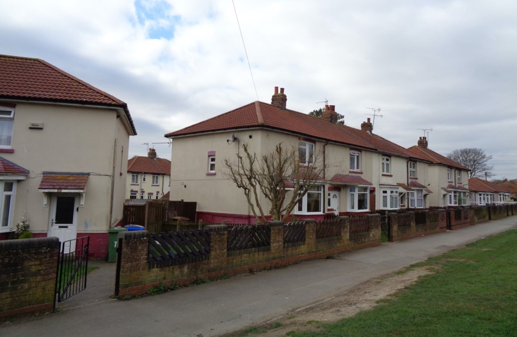
In the end, helped by a 1920 boundary extension which incorporated Cosham and Wymering on the mainland to the north, Portsmouth built 591 homes under Christopher Addison’s 1919 Housing Act.  Among the largest estates were Henderson Road in Eastney, with 254 homes, and what was called a little grandiloquently Wymering Garden Village. After that, the Council’s eloquence failed and most of the estate’s hundred or so new houses – good quality homes along tree-lined streets – were built on First, Second and Third Avenues off Medina Road.

Wymering Medina Road 1924 SN

Unusually this pair of houses on Medina Road, Wymering, is precisely dated: 1924

Lloyd George’s promise and Addison’s programme were cut short by spending cuts in 1921 but municipal housebuilding was revived by Housing Acts in 1923 and, more importantly, 1924.  Portsmouth built 951 homes under the 1924 Act, most dotted around the island, a few to the far north on Portsdown Hill.

Voller Street St Faiths Road

Cottage flats, St Faiths Road

Nationally, the housing programme took a new direction in 1930 when Arthur Greenwood’s Housing Act targeted slum clearance and the rehousing of its residents for the first time. Here Portsmouth was ahead of the game, having demolished 381 derelict homes in Portsea under the 1924 Act.  Eighty-nine further homes were cleared around Voller Street in Landport.  The street disappeared but the 52 cottage flats built to replace them on St Faiths and Temple Streets remain.

Campaigning by the local press may have played its part. The Evening News invited readers on the waiting list – over 1000-strong in 1924 – to send details of their housing circumstances and it publicised the most egregious cases, for example a five-roomed cottage inhabited by twelve people: ‘the applicant has six children and his wife died of tuberculosis and the lodger is in the last stages of the disease’, it reported. (4)

Isle of Wight Estate Brightstone Road SN

Brightstone Road, Isle of Wight Estate

Portsmouth built a further 1148 homes under the 1930 legislation – houses in Landport and Portsea on the island and major schemes to the north in Wymering, north of Whitstable Road and south of Medina Road on the so-called Isle of Wight Estate where roads were named after Wight towns.

Slum clearance remained a priority, however, pushed by central government and encouraged by Mearns Fraser’s successor as Medical Officer of Health, Dr AB Williamson, who described slums as ‘radiating centres of disease and health and mental degradation’ at a local church conference in 1934.   That message was endorsed by Councillor AE Allaway, chair of the Health Committee, who was clear that ‘money spent on slum clearance will be more than saved in other health services’. (5)

For the moment, Portsmouth was prepared to put its money where its mouth was. The Council had scheduled (declared for clearance) fifteen areas, nine of them on the island, involving the demolition of 796 homes and the rehousing of some 3659 residents. Some 508 individual insanitary houses were additionally slated for demolition. In total, the Council estimated around a 1000 new council homes would be required. (6)

AE Allaway

Cllr AE Allaway

The issue of where this housing should be was also beginning to preoccupy the Council.  Councillor Allaway hoped that by means of three-storey flats it would be possible to ‘to put quite one-third more people on the sites than if we built houses’.  By 1937, turning back to the pioneering work of Andrew Mearns Fraser, a Special Committee of the Council had been convened ‘to consider the layout of the Portsea area’. (7)  The time and expense of travel to work from distant Corporation suburbs were a particular issue for many of the poorer residents displaced from central Portsmouth.

Privett House, off Cumberland Street, Portsea CC Mike Faherty

Privett House © Mike Faherty and made available through a Creative Commons licence

By 1939, the Council had built 2806 new homes. Around 430 of these were flats in the inner city including those in Privett House, a five-storey block north of Cumberland Street, commenced in the late 1930s.

Blitz Portsmouth 1950

This image of the centre of Portsmouth with cleared bombsites in 1950 shows the extent of the impact of wartime bombing.

But that constructive work was rapidly overshadowed by the devastating impact of the Blitz on Portsmouth. From July 1940 to May 1944, the city suffered 76 air raids and some 930 civilians were killed. It was estimated 6625 houses were destroyed – around 10 percent of housing stock – and a further 6549 severely damaged.

Blitz Conway Street Landport 1940

This photograph of Conway Street in Landport in 1940 shows its personal impact.

Typically, planning for the post-war world began early with the Council setting up a Special Replanning Committee in February 1941. It was boosted by a visit from Lord Reith, Minister of Works and Buildings, in March at which he urged Portsmouth ‘to plan boldly and on a large scale … with the expectation that a good many of the difficulties that have prevented them doing so in the past will be adjusted’. FAC Maunder, then Deputy City Architect, was tasked with preparing preliminary proposals for the Council. (8)

Other interested parties also made their views known. A Replanning Advisory Panel of the Chamber of Commerce, set up in July 1941, recommended the dispersal of around 50,000 of the city’s current population to large new settlements on the mainland. In 1943, the Replanning Committee of the local Labour Party urged municipally owned estates and ‘self-contained houses wherever possible’.  Despite their political differences, both reports opposed flats except, in the Labour Party’s words, ‘in a few instances where absolutely necessary’. In this, they captured popular sentiment: a Mass Observation survey in the city showed 92 percent wanting to live in a house rather than flat. (9)

Maunder’s report, accepted with one dissentient, was published in February 1943 and largely followed these lines. It advocated an urban (in effect, island) population of 150,000 at no more than 70 persons per acre, grouped – the coming idea – into neighbourhood units. Its big idea was to disperse around 60,000 of the current population into two new settlements, one around Leigh Park (on land within Petersfield Rural District and Havant and Waterloo Urban District) – envisaged as a satellite town, ‘the Garden City of the South’ – and another, more of a dormitory estate, around Waterlooville.  Maunder himself was appointed City Planning Officer heading a new City Planning and Reconstruction Department in July 1944.

FGH Storey

Cllr FGH Storey

Little could be achieved under the exigencies of war but the Council had already acted boldly as Reith had advised in setting in motion the purchase of land at Leigh Park. It had rather daringly entrusted Conservative councillor FGH Storey with full powers to negotiate the deal as early as August 1943 and the land (with an additional extension in 1946) was bought in 1944.

We’ll continue this story in next week’s post, examining what became – amongst other things – of those high ideals around Leigh Park and the conflicting ideas around suburban and inner-city development.

Sources

(1) Portsmouth City Council, A History of Council Housing in Portsmouth (2011).  The ‘northern city’ quotation is drawn from John Ashmore, ‘Rebalancing Britain: The northern city on the south coast’, CAPX, 18 July 2019.

(2) Andrea Verenini and Fabiano Lemes De Oliveira, ‘The Ambiguity of Town Planning: Innovation or Re-Interpretation?’, 15th International Planning History Society Conference, July 2012

(3) Details drawn from ‘Portsmouth Council. More About the New Houses: their Cost when Erected’, Hampshire Telegraph and Post, 14 May 1920 and ‘Portsmouth’s Housing. The Council and the Hill Scheme’, Portsmouth Evening News, 4 December 1920

(4) ‘Portsmouth’s Terrible Record. Facts for the Town Council’, Portsmouth Evening News, 31 December 1924

(5) ‘Slum Clearance’, Portsmouth Evening News, 6 March 1934

(6) Councillor AE Allaway, ‘The Housing and Slum Clearance Problem in Portsmouth’, Journal of the Royal Sanitary Institute, vol 55, no 1, January 1934

(7) ‘Portsmouth Slum Clearance’, Portsmouth Evening News, 28 April 1937

(8) ‘Plan Boldly’, Portsmouth Evening News, 21 March 1941

(9) Tatsuya Tsubaki, Post-war Reconstruction and the Questions of Popular Housing Provision, 1939-1951, PhD thesis in Social History, University of Warwick, 1993

(10) ‘Portsmouth City Council Buy Leigh Park Estate’, Portsmouth Evening News, 9 February 1944

Share this:

  • Twitter
  • Facebook
  • Email
  • More
  • Tumblr
  • LinkedIn
  • Reddit
  • Pinterest

Like this:

Like Loading...

Red Vienna, Part II: ‘Die Ringstrasse des Proletariats’

31 Tuesday Mar 2020

Posted by Municipal Dreams in Europe, Housing, Vienna

≈ 4 Comments

Tags

1920s, 1930s

Last week’s post looked at the genesis of Red Vienna’s stupendous interwar housing programme. In this, we’ll examine and assess its built accomplishments and address its tragic conclusion.  With almost 62,000 new flats constructed in some 348 schemes, there’s a lot to cover but here I’ll take you on a virtual tour of some of the estates I got to see in person when I visited the city earlier this year. Conveniently, they also offer a roughly chronological overview.

Metzleinstaler Hof SN

Metzleinstaler-Hof

Vienna’s first Gemeindebau (municipal tenement block) of the new era and in many ways the model for what followed was Metzleinstaler-Hof on Margaretengürtel, about 2.5 miles south-east of the city centre, completed in extended form in 1925.

Ringstrasse bannerIt would help form what some called the Ringstrasse des Proletariats – a deliberate echo of and challenge to the monumental Ringstrasse (literally a ring road but more a grand boulevard) created around Vienna’s inner core under Hapsburg rule.

Herbert Gessner

Herbert Gessner

The chief architect of Metzleinstaler-Hof was Herbert Gessner. Gessner, though trained by leading imperial architect Otto Wagner at the Vienna Academy of Fine Arts in the 1890s (as were the majority of his colleagues) was a more ‘political’ architect than some, moving in Social Democratic circles and undertaking work for the Austrian labour movement before the First World War. He became a trusted leading figure for many of Red Vienna’s housing schemes of the 1920s.

At Metzleinstaler-Hof, a potentially austere exterior is enlivened by decorative detail and bay windows; a quiet inner courtyard is less obvious and accessible than would be the case in later schemes. Its 250 flats are tiny but the scheme’s essential breakthrough was the inclusion of a bathhouse, laundry, library and nursery – a clear indication of the communal facilities that would be the hallmark of the Social Democratic housing programme.

Matteottihof

Matteotti-Hof @ Wikimedia Commons

Matteotti-Hof (named after the Italian socialist murdered by fascists in 1924) – a 423 apartment block designed by Heinrich Schmid and Hermann Aichinger and completed in 1927, lies to the rear.

Reumann Hof SN 1

Reumann Hof Doorway SN 1

Reumann-Hof

Back on Margaretengürtel, Reumann-Hof, another Gessner design completed in 1926, lies immediately to the north. It’s a larger and more grandiose scheme reaching eight storeys (more were planned but financial constraints intervened), comprising 392 apartments and 19 shops.  To the side of its grand façade, set back from the street, majolica-tiled entrances lead to green, shaded courtyards.

Karl Lowe Gasse SN

No. 4 Karl-Löwe-Gasse

A ten-minute walk to the east gets you to one of the largest complexes of social housing in Vienna, either side of Längenfeldgasse. On the way, you might pass no. 4 Karl-Löwe-Gasse. It’s a small 1930 scheme of 18 apartments designed by Anton Potyka – not a showpiece but just one of the hundreds of such blocks built by the municipality at this time.

Reismann Hof SN

Reismann-Hof

Reismann-Hof, just beyond, is, by contrast, one of the Red Vienna’s eight ‘superblocks’, comprising 623 apartments, officially opened in 1925. The scheme was originally named Am Fuchsenfeld but was dedicated after the Second World War to the memory of Edmund Reismann, a Social Democratic politician murdered in Auschwitz in 1942.

Fuchsenfeld Hof SN

Fuchsenfeld Hof Interior SN 3

Fuchsenfeld-Hof

Its architects Heinrich Schmid and Hermann Aichinger also designed Fuchsenfeld-Hof just across the road and built at around the same time. The scheme is celebrated for its series of landscaped courtyards and, in its heyday, a children’s paddling pool now converted to a playground.

George Washington Hof SN 2

George Washington Hof SN 3

George Washington-Hof

If you’re following me geographically, it’s a brisk fifteen-minute walk to the south to get to George Washington-Hof – another of the ‘superblocks’ with some 1084 apartments. It’s an unusually extensive scheme too, reflecting the struggle around its design between those advocating a ‘garden city’ style and those a more urban tenement design. The relatively low-rise design and extensive, attractive landscaping offered a compromise somewhere between the two. If you look closely around the complex, you’ll see a contrast between the work of the two architects involved: Karl Krist’s plain façades and the more decorative pebble-clad façades, glazed verandas and pointed-gabled staircases of Robert Örley.

Karl Marx Hof Plan SNFrom here, there’s no direct route to Karl-Marx-Hof in the north but a trip on the tram to Karlsplatz and a rail journey from there to Heiligenstadt station takes around forty minutes and will give you an idea of the transport infrastructure that was vital to the Social Democrats’ urban programme. Karl Marx-Hof itself – or some of it as it’s pretty big (four tram stops from end to end to keep the transport focus going) lies immediately adjacent to the station.  It was built deliberately in the then elite Nineteenth District of Vienna, not least to shore up Social Democratic voting in the district.

Karl Marx Hof SN 2

Karl Marx Hof Courtyard SN 2

Karl Marx Hof Entrances SN

Karl Marx-Hof

What is there to say about Karl-Marx-Hof, built between 1927 and 1930, that hasn’t been said before?  In some respects, the numbers alone are the most telling thing.  Stretching 1100 metres along Heiligenstädter Strasse, the complex forms the longest contiguous residential building in the world. Its 1382 flats housed around 5000 people. Beyond homes, the overall scheme, designed by Karl Ehn, provided nurseries, a range of medical facilities, a library, shops, cafes and meeting rooms. (One of the former laundries now houses an historical exhibition on Red Vienna.) There was also a lot of open space: with just 20 percent of the 37-acre (15 hectare) site accommodating housing, the rest provided areas of rest and recreation including a number of children’s playgrounds.

Karl Marx Hof Sculptures SN

‘Liberation’ and ‘Childcare’ by Josef Franz Riedl

Hopefully, the images can provide a sense of that scale and its architectural form. The ceramic sculptures by Josef Franz Riedl above the main archways represent ‘Enlightenment’, ‘Liberation’, ‘Childcare’ and ‘Physical Culture’ – an apt summary of the revolutionary purpose underlying the built form of Karl Marx-Hof. This was indeed, in the words of Owen Hatherley, ‘a rare example of architecture both as political instrument and ideological symbol’. (1)

Friedrich Engels Platz Hof

Friedrich Engels Platz-Hof

From Karl Marx-Hof to Friedrich Engels Platz-Hof to the east is a 15-minute bus ride. Designed by Rudolf Perco, this was, with 1467 apartments, the second largest of the Red Vienna schemes after the Sandleitenhof in Ottakring. It is notable too for its more modernist appearance and ‘stark cuboid aesthetics’.  It was one of the schemes to include a communal kitchen. The striking chimney of the communal laundry was described as a ‘new Viennese landmark’ at the scheme’s opening ceremony in 1933. (2)

Friedrich Engels Platz Hof Laundry Tower SN

Friedrich Engels Platz-Hof laundry tower

That ceremony took place in July 1933. Hitler had been installed Chancellor of Germany six months earlier and the defiant words of Karl Seitz, the Social Democratic mayor of Vienna who performed the ceremony, therefore held especial significance:

Karl_Seitz 1925Even if the world is to become filled with devils, this Vienna will stand unmoved and firm, a haven of democracy, a haven of the spirit, a haven of liberty, a bulwark against fascism and dictatorship.

In the event, Red Vienna’s resistance to the Austro-fascist coup of Engelbert Dollfuss was brave but short-lived. Insurgents of the Republikanischer Schutzbund – the defensive paramilitary organisation of the Social Democratic Party – took up arms in February 1934, many based in the Gemeindebauten which were viewed by supporters and detractors alike as working-class fortresses, both in form and function.

Karl Marx-Hof 1934

Karl Marx Hof Plaque SN

Karl Marx-Hof, after shelling in February 1934, and a modern commemorative plaque

Reumann-Hof, George Washington-Hof and Karl Marx-Hof, amongst others, were scenes of heavy fighting but, facing both the full force of the Austrian state and the threat of heavy civilian casualties, they quickly surrendered.  Up to 1000 members of the Schutzbund were killed; severe political reprisals followed. For the time being, the transformative political project of Red Vienna had come to an end.

Without detracting from that ambition and daring, it’s worth in conclusion assessing the impact of that project.  In practical terms, even by contemporary standards: (3)

the individual apartments in the Gemeindebauten were small and minimally equipped. They had running water, toilets, gas, and electricity but no ‘luxury fittings’ such as bathtubs or showers, built-in cupboards, or closets.

Three-quarters of the apartments, into the mid-1920s, were no larger than 38 square metres (just over 400 square feet) in size and comprised only a small entrance hall, living room and kitchenette, toilet and one full-sized room.

Karl Marx Hof Kindergarten SN

Karl Marx-Hof

George Washington Hof Kindergarten SN 3

Decorative detail at the kindergarten of George Washington-Hof

The planning and political emphasis, of course, was on the schemes’ shared communal facilities – their laundries, washhouses, nurseries, cafeterias, libraries and meeting rooms.  Through this community provision, together with homes far better and cheaper than they had known before, the Social Democrats’ urban programme was intended not only to consolidate political support for the party among the Viennese working class (which it very largely did) but herald and forge a new socialist consciousness.

To critics such as the Marxist Manfredo Tafuri, that was a ‘declaration of war without any hope of victory’, and the project – the Austro-Marxist belief in revolution through reform – essentially petit-bourgeois in conception and execution.  In one sense, this judgement – given the events of 1934 and the 1938 Anschluss which incorporated Austria into Nazi Germany – is self-evidently true but I’ll leave the bigger ideological debate to others. (4)

01WS_raum_zentriert2_web

KarlMarxHof_08

Ironing Room

Washhouse, laundry and ironing rooms of the Gemeindebauten

To continue for the moment this more sceptical strain, later revisionist historians have questioned whether even the greater freedom for women promised by the communal facilities was fulfilled in practice.  Children weren’t eligible for kindergarten places till four; use of the laundries (under male supervision) was restricted to one allocated day per month. For many women, domestic duties and the double shift (of paid and home work) would continue to weigh heavily.

Political opponents have even labelled the whole enterprise, with its strict rules governing residents’ behaviour within and beyond their apartments, a form of benevolent but repressive paternalism.  For my part, these rules might be read differently – as a conventional expression of working-class respectability, as recognition of the necessary consideration to others imposed by communal living, or just the rather typical rules imposed by landlords of all political stripes.

Friedrich Engels Platz Hof 3

A courtyard at Friedrich Engels Platz-Hof

Against the enormous scale and sweeping aspiration of Red Vienna’s housing programme, such criticisms can seem querulous. They are a necessary reminder of real-world limitations and the perhaps unavoidable contradictions of any ambitious programme of political reform. But Vienna’s Social Democrats built homes for 200,000, provided high-quality educational, health and cultural facilities to many more, and led a regime which placed working-class needs and interests at its very heart – rare then, as rare now.

To a contemporary observer, the British journalist GER Gedye, they provided: (5)

the best object lesson in the world of what Socialism can and cannot do on a democratic basis in a Socialist capital of an anti-Socialist State.

And for all the tragic rupture of Nazism and war, that lesson lives on. The City of Vienna currently owns and manages over 226,000 homes, housing one in four – around 500,000 – of the city’s population. Red Vienna didn’t bring socialism and perhaps had only limited success in forging a new socialist consciousness but it did, in the earlier words of Social Democratic politician Robert Danneberg, ‘perform useful instalments of socialist work in the midst of capitalist society’.

In next week’s post, we’ll examine Alt-Erlaa, a contemporary showpiece of Viennese social housing, and housing policy since the Second World War.

Notes

For a good film essay on the history of Vienna’s social housing, see Angelika Fitz and Michael Rieper, How to Live in Vienna (2013) with English subtitles.

Sources

(1) Owen Hatherley, ‘Vienna’s Karl Marx Hof: architecture as politics and ideology’, The Guardian, 27 April 2015

(2) Liane Lefaivre, Rebel Modernists: Viennese Architects since Otto Wagner (Lund Humphries, 2017)

(3) Eve Blau, The Architecture of Red Vienna, 1919-1934 (MIT Press, 1999)

(4) Manfredo Tafuri, Vienna Rossa (Electa, 1980) quoted in Eve Blau, Re-Visiting Red Vienna as an Urban Project.

(5) Quoted in Blau, The Architecture of Red Vienna, 1919-1934

The fullest and most detailed guide to the individual schemes is provided (in German) on the City of Vienna’s Wiener Wohnen website.

Share this:

  • Twitter
  • Facebook
  • Email
  • More
  • Tumblr
  • LinkedIn
  • Reddit
  • Pinterest

Like this:

Like Loading...

Red Vienna, Part I: ‘Useful instalments of socialist work’

24 Tuesday Mar 2020

Posted by Municipal Dreams in Europe, Housing, Vienna

≈ 9 Comments

Tags

1920s, 1930s

Back in early February, we travelled to Vienna on holiday.  Ironically, the only thing affecting our travel was Storm Ciara which disrupted the return journey.  This post is published in very different circumstances.  Stay safe and stay well. 

The Gemeindebauten (municipal tenement blocks) of Red Vienna are probably the most celebrated council housing in the world – epic in conception, construction and, in 1934, conclusion.  When the programme ended, one in ten Viennese citizens – around 200,000 people – lived in municipal housing: the city had built some 61,175 apartments in 348 tenement blocks and around 5250 houses on 42 more suburban estates.

Red Vienna Map

A contemporary map depicting the extent of Vienna’s urban programme in the 1920s

Whilst the numbers are impressive, Vienna’s ambition went further.  This was not merely a housing programme. In the words of Eve Blau, its foremost chronicler, this was ‘a comprehensive urban project that set itself task of making Vienna a more equitable environment for modern urban living’; beyond housing, it provided: (1)

a vast new infrastructure of health and welfare services, clinics, childcare facilities, kindergartens, schools, sports facilities, public libraries, theatres, cinemas, and other institutions.

Reumann Hof Kindergarten SN 1

The kindergarten at Reumann-Hof

The dramatic context for this unheralded experiment lay in the collapse of the Austro-Hungarian Empire in 1918.  The population of the rump Austrian state which emerged stood at 5 million, less than a tenth that of the former empire. Vienna itself, the erstwhile imperial capital, had, at peak in 1910, a population of 2,031,000.  A post-war coalition was formed of the Christian Social Party and the Social Democratic Workers’ Party of Austria (SDAPÖ) to cope with the immediate crisis. And in the May 1919 local elections, Vienna became the first major city in Europe governed by socialists; Jakob Reumann, of the SDAPÖ, its first socialist mayor.

Otto Bauer

Otto Bauer

The party’s leader and chief theoretician was Otto Bauer. Bauer today is chiefly remembered – alongside other leading thinkers such as Max Adler, Karl Renner, Friedrich Adler, and Rudolf Hilferding – as a proponent of Austro-Marxism. This, they believed, was a corrective to the narrow economic determinism of ‘vulgar Marxism’ – a revised theory and practice that ascribed an active role in social development to ideology and culture; a ‘Third Way’ that envisaged the possibility of revolution through reform. The Gemeindebauten were to be its practical expression.

Siedlung am Wasserturm 1928

Siedlung ‘Am Wasserturm, 1928

Initially, however, the Viennese municipality under Reumann pursued an architecturally more conservative strategy though a series of peripheral garden suburbs. Some of these Siedlungen were built by the municipality, some by cooperatives; they were inspired by both the established Garden City ideals of Ebenezer Howard and the contemporary practice of Weimar Germany.  In 1921, however, the housing shortage remained severe with over 30,000 families squatting public and private land on the city fringes in a series of so-called ‘wild settlements’. (2)

Breitner

Hugo Breitner

The major – political and financial – shift occurred in 1922. Austria’s new 1920 constitution had created a federal state and, within that, a Province of Lower Austria comprising both Vienna and rural hinterlands. It suited both conservative and radical politicians that Vienna became a wholly self-governing province in 1922. Crucially, this allowed the municipality to pursue an independent taxation policy. Under Hugo Breitner, Minister of Finance, it did so with daring and finesse.

Breitner inaugurated a progressive tax regime with levies on luxury goods and services and, most notably, a Wohnbausteuer (Housing Construction Tax) on rents, so powerfully skewed that the largest 0.5 percent of residences accounted for 42 percent of revenues; the 90 most expensive properties paid as much tax as the 350,000 least expensive. (3)

Wohnbausteuer SN 2

One of the many plaques recording the contribution of the Wohnbausteuer to Vienna’s building programme. This one is on a block in Langenfeldgasse

By 1927, Breitner’s taxes provided almost 20 percent of the City’s income. They also enabled rents – calculated to cover only regular maintenance and repair costs – to be kept low; a typical semi-skilled household in a municipal flat paid an average of 3.5 percent of income in rent. Combined with efficient borrowing and administration and the economies of scale enabled by Vienna’s huge construction programme, this made for a highly successful economic model for the ambitious City Council.

That ambition became clear in 1923 when the council announced its intention to build 25,000 new homes in five years. For the first time, these were very largely urban tenements. There were practical reasons for this change of policy – the difficulty of building beyond city limits and the expense of infrastructure at those fringes – but it was, principally and ideologically, a positive decision.  As Robert Danneberg, president of the new Provincial Assembly of Vienna, declared: (4)

Capitalism cannot be abolished from the Town Hall. Yet it is within the power of great cities to perform useful instalments of socialist work in the midst of capitalist society.  A socialist majority in a municipality can show what creative force resides in Socialism. Its fruitful labours not only benefit the inhabitants of the city, but raise the prestige of Socialism elsewhere.

The Gemeindebauten were conceived as the ‘social condensers’; this was ‘architecture as a way to forge radical new kinds of human collectivities’ in the words of Michał Murawski and Jane Rendell.  Urban living – and the socialised infrastructure to be provided – was seen as a means to transform a traditional Volkskultur (popular or folk culture) into a new Arbeitskultur (working-class culture).  Karl Seitz, who replaced Reumann as mayor in 1923, was clear that the goal was:

to educate our young not as individualists, outsiders, loners. Rather they should be raised communally and be brought up as socialised individuals.

A broader cultural programme augmented these efforts – a Workers’ Symphony Orchestra, a weekly cultural magazine named Der Kuckuck (a cuckoo heralding a new proletarian spring presumably) and organised programmes of workers’ sports and dancing, for example.

Opening march of the 1931 Workers' Olympiad in Vienna Wikimedia Commons

The opening march of the 1931 Workers’ Olympiad held in Vienna. The banner reads ‘Workers of all the world unite in sport’.

Architecturally, however, the new blocks disappointed interwar modernists. These were not the sleek Zeilenbauten – slab blocks oriented north-south away from the street and toward sun and greenery – favoured by the Congrès Internationale d’Architecture Moderne.  The new schemes were inserted directly into the existing urban fabric and were, superficially at least, more reminiscent of Vienna’s traditional perimeter blocks (though with a nod too to the earlier municipal housing of the Amsterdam School). Decoratively, they sometimes echoed features of even older Baroque Habsburg building. (6)

Ringstrasse_02_Metzleinstaler_WSKMH

An early photograph of the first of the Gemeindebauten, Metzleinstaler-Hof.

But this was a knowing cultural appropriation and one that differed in key respects from those earlier models. Critically, and in contrast to the privatised inner spaces of the traditional perimeter blocks, grand entrances led from the public space of the street to the semi-public and communal space and facilities of the large inner courtyards which often took up to four fifths of the schemes’ overall area. This was, to quote Eve Blau yet again, ‘a new kind of commons, a new form of communal space in the city’. And whereas working-class tenements had previously been situated along long central corridors with shared toilets at their end, these were replaced by stairwells serving just three or four apartments.

Karl-Marx-Hof (c) Wien Musem

An early photograph of Red Vienna’s most celebrated housing scheme, Karl Marx-Hof

Around 190 architects were involved in the planning and design of the Gemeindebauten but a large number were shaped by the example and teaching of Otto Wagner – ‘a modernising imperial architect who pioneered a rationalistic, stripped-down approach’ – at the Vienna Academy of Fine Arts before the First World War. (7)

It’s time for a closer look at the schemes themselves but for that virtual tour – the  best we can manage for the time being – you’ll have to wait for next week’s post.

Sources

(1) Eve Blau, Re-Visiting Red Vienna as an Urban Project

(2) Andreas Rumpfhuber, ‘Vienna’s ‘wild settlers’ kickstart a social housing revolution’, The Guardian, 8 April 2016

(3) See Eve Blau, The Architecture of Red Vienna, 1919-1934 (MIT Press, 1999) and Liane Lefaivre, Rebel Modernists: Viennese Architects since Otto Wagner (Lund Humphries, 2017). See also Jannon Stein, ‘The Propaganda of Construction’, Jacobin, 10 March 2014.

(4) Quoted in Eve Blau, ‘From Red Superblock to Green Megastructure: Municipal Socialism as Model and Challenge’, in Mark Swenarton, Tom Avermaete and Dirk van den Heuvel (eds), Architecture and the Welfare State (Routledge, 2014)

(5)  Michał Murawski and Jane Rendell, ‘The social condenser: a century of revolution through architecture, 1917–2017’, The Journal of Architecture, vol 22, no 2, 2017

(6) Anson Rabinbach, Red Vienna: A Workers’ Paradise

(7) Owen Hatherley, ‘Vienna’s Karl Marx Hof: architecture as politics and ideology’, The Guardian, 27 April 2015

Share this:

  • Twitter
  • Facebook
  • Email
  • More
  • Tumblr
  • LinkedIn
  • Reddit
  • Pinterest

Like this:

Like Loading...

Council Housing in Holborn, Part I: Early Council Housing to 1945

28 Tuesday Jan 2020

Posted by Municipal Dreams in Housing, London

≈ 7 Comments

Tags

1920s, 1930s, Holborn, Pre-1914

Holborn, created in 1900, was at just 403 acres the smallest of the London boroughs. With a population to match – declining from 59,000 when established to barely 22,000 on abolition in 1965 – and an overwhelmingly Conservative council, neither was it in the forefront of council housebuilding. Still, it has a rich council housing history and after 1945, with Sydney Cook as Borough Architect (who would go on to make his name in the same office at Camden), it stood in the forefront of modernist design.

Map

Holborn can be seen near the centre of this interwar map of the Metropolitan Boroughs. Together with St Pancras and Hampstead, it would form the London Borough of Camden from 1965.

This first post will look at its earlier history and begins with what the Survey of London describes as ‘the first council housing in England’.  In fact, Corporation Buildings on Farringdon Road, completed in 1865, were built by the City of London, largely at the initiative of Alderman Sydney Waterlow, better known as the founder of the Improved Industrial Dwellings Company. For that reason and given the nature of the City of London Corporation, I place it more strongly in the Victorian tradition of philanthropic housing and, like most of these early ‘model dwellings’ and their relatively high rents, its 168 tenements housed the better-off working class and the lower middle class.  The buildings were demolished in 1970. (1)

Corporation Buildings, Farringdon Road

An early engraving of Corporation Buildings, Farringdon Road

The City of London built another block, Viaduct Buildings containing 40 tenements, in 1880 but it was the London County Council (LCC), created in 1889, that built most of Holborn’s council housing proper before the First World War.  The LCC’s first scheme was a small one, intended to clear and improve a run-down area between Brooke Street and Leather Lane. Completed in 1897, Cranley Buildings (unusually three-storey tenements rather than the five that was the norm) comprised just twelve two- and three-roomed tenements, housing 60 people. Only 55 had been displaced by slum clearance but the usual problem of high rents ensured that these new residents too were the better-off rather than the poorest who had previously lived in the area. (2)

Cranley Buildings SN

Cranley Buildings

The LCC’s next scheme, the Bourne Estate, south of Clerkenwell Road, was a much grander affair: eleven principally five-storey blocks containing some 763 homes: (3)

designed by the LCC Architect’s Department in a free Classical style, with Arts and Crafts touches … [of] international significance as the model for the much admired and highly influential public housing erected in Vienna immediately after the First World War.

It’s the grand arches which find their greatest echo in the later Austrian schemes but the attractive green courtyards of the Bourne Estate contain little of the communal buzz sought by Red Vienna.

Bourne Estate SN

The Bourne Estate

Holborn was far from alone among the metropolitan borough councils in building no council housing of its own before 1914 but its overwhelmingly Conservative membership no doubt made that decision easier.  Two Labour councillors were elected in 1919 but they soon lost their seats and through most of the 1920s the Council was wholly Conservative.

The First World War and its aftermath – and specifically the promise of ‘Homes for Heroes’ – had changed much in 1919 and the celebrated Housing Act of that year required that all councils not only survey local housing needs (within three months!) but actively prepare schemes to meet them.  Holborn went through the motions, going so far as to inspect four possible sites for council housing, but finally concluded that: (4)

Although from a purely public health point of view there is at present necessity existing in the Borough for better housing accommodation for the working classes, many other factors have to be taken into consideration by the Council.

To be fair, there was some truth in the factors identified: population movement from central London, cheaper and better housing in suburban districts, cheaper commuting, and Holborn’s growing significance as a business centre. But they didn’t obviate the pressing problems of the day, not least the 611 unadapted large family houses now in multiple occupation.  Clearly, political opposition to public housing remained the determining factor for the Council’s Conservative majority.

The 1919 report identified a precise total of 999 LCC flats in the borough. This number was not added to in the interwar period but Holborn itself did in the end build some 92 council homes by the early 1930s – only Chelsea and Paddington Metropolitan Boroughs provided fewer in the period.

Betterton House SN

Betterton House

Holborn’s first council housing was built on Betterton Street in Covent Garden. Betterton House was opened in 1927 by Prince Arthur of Connaught, a small, five-storey infill block of 15 tenements designed by Borough Surveyor JE Parr, replacing buildings declared derelict. The arched front entrance led to a stairway providing balcony access at the rear. Fifteen further tenements were added in a 1930 extension. A small but active Labour opposition group on the council were denouncing the flats as ‘slums’ by the later 1930s. (5)

Boswell House SN

Boswell House. Richbell, a post-war block, lies to the immediate right set back from the previous street line.

The Council’s next scheme – Boswell House in Boswell Street, Bloomsbury – also designed by Parr, comprised 62 flats and was opened in 1932.  There were over 400 applicants for the new homes; the lucky few selected were: (6)

Holborn residents living in unsatisfactory conditions, in a number of cases being large families in single room tenements. Many of the tenants are employed in market work, in hotels and restaurants, or other occupations where the hours of work necessitate residence near to the place of work.

The design details provided by the Medical Officer of Health suggest the Council took some pride in the scheme: (7)

All the flats will have a well-ventilated larder, sink, draining board, dresser-cupboard, gas cooker, copper-boiler, bathroom and W.C., coal bunker, cupboards, shelving, hat and coat racks, etc. … A playing yard is provided for children, and the blocks of flats have been so arranged as to provide the maximum amount of sunshine, light and air for the dwellings. The flats, balconies, staircases and the yard will be lighted at night by electric light.

This was, unusually, a seven-storey scheme (the top two floors were maisonettes), necessary to make fullest use of the restricted, one-third of an acre, site. Almost uniquely, for a council housing scheme before the 1946 special lifts subsidy, it contained two service lifts. In this, at least, Holborn was ahead of the game.

That does, however, represent the peak of its pre-war housing record. The context is important – a population that by 1937 was estimated to have fallen to 34,600 – but on other measures housing need remained severe. From 1930, housing legislation focused on slum clearance and rehousing.  The 1935 Housing Act required all local authorities to undertake a survey of overcrowding in their districts.  In Holborn, by the modest criteria of the day, 700 families were found to be living in overcrowded conditions, over nine percent of the local population. This placed Holborn tenth among the capital’s 28 Metropolitan Boroughs for overcrowding. Much therefore remained to be done.

Much more after the devastating impact of the Blitz.  Some 650 buildings were destroyed in Holborn (one seventh of the Borough’s total) and 426 people killed. Around 282 high explosive bombs fell at the height of the Blitz in April-May 1941 and a number of V1 and V2 rockets in a second wave of attacks in 1944. Per head of population, Holborn was reckoned the worst hit administrative district in the country. (8)

Buckea's Bakers Shop, corner of Boswell Street and Theobalds Road 1945

An image of Buckea’s Bakers Shop on the corner of Boswell Street and Theobalds Road taken in 1945.

The political impact of the war seems almost as seismic.  In the general election of June 1945, Irene Marcousé, elected a local councillor in 1939, stood for Labour in Holborn. She posed the all-important question of the day: (9)

Who is going to win the peace? Are you – the ordinary citizens of Holborn and Britain?  Or are THEY – the privileged few who have always cheated you and the peace and plenty you have earned?

Marcousé didn’t win but she came within 925 votes of the victorious Conservative candidate on a 19-point swing in a two-horse race. This was a very creditable result in Holborn where business voters – those with a vote through ownership of business premises in the constituency – represented around 6 percent of the electorate. (Plural voting was abolished for parliamentary elections in 1948 but remained in local elections – and significant therefore in Holborn – till 1969.)

Across the country, Labour gained 239 seats to form its first (landslide) majority government. This was a harbinger of the November local elections in which Labour took control of the Borough for the first and only time, winning 24 seats to the Tories’ 18.  Marcousé became leader of the Council and chair of the Housing Committee.

It’s worth a pause here to take a look at Marcousé and the new council. Marcousé was born in East Prussia in 1900 and educated in Belgium before graduating from the universities of Heidelberg and London. Frank Dobson, Labour MP for Holborn and St Pancras in later years, recalled she could sing The Internationale in English, French and German.  She had married Hugh Chaplin (Principal Keeper of the Department of Printed Books at the British Museum and a fellow Labour activist) in 1938; together they lived in Russell Square.  But she was, in Dobson’s words, ‘a hard-bitten, awkward and effective old socialist’. Better known as Ina Chaplin, she would represent the party on the LCC, Greater London Council and Inner London Education Authority till 1977. (10)

Under Marcousé’s leadership, in what almost might be described as the ruins of Holborn, the Council  opened information and social centres in disused and bomb-damaged premises, created new children’s playgrounds, organised open-air entertainments in local squares, and published a regular council newsletter. It was a broad and cultural programme that seems in some ways to prefigure the New Left politics of later years.

But the key issue was housing and we’ll examine its record on that and the longer post-war story next week.

Sources

(1) Philip Temple (ed), Farringdon Road‘, Survey of London: Volume 46, South and East Clerkenwell, (2008)

(2) Fuller detail is provided in Martin Stilwell, Housing the Workers Early London County Council Housing 1889-1914, 10: Brooke’s Market, Holborn Scheme (pdf)

(3) Historic England, Bourne Estate (Northern Part), Denys House, Frewell House, Ledham House, Radcliffe House, Redman House, Scrope House, Skipwith House: listing details

(4) Holborn Metropolitan Borough Council, Annual Report of the Medical Officer of Health, 1919 (Wellcome Library, London’s Pulse: Medical Officer of Health reports, 1848-1972)

(5) Holborn Metropolitan Borough Council, Annual Report of the Medical Officer of Health, 1927 (Wellcome Library, London’s Pulse: Medical Officer of Health reports, 1848-1972). On Labour, see Sean Creighton (Labour Heritage), Labour in Holborn in the 1930s and 1940s.

(6) Holborn Metropolitan Borough Council, Annual Report of the Medical Officer of Health, 1933 (Wellcome Library, London’s Pulse: Medical Officer of Health reports, 1848-1972)

(7) Holborn Metropolitan Borough Council, Annual Report of the Medical Officer of Health, 1932 (Wellcome Library, London’s Pulse: Medical Officer of Health reports, 1848-1972)

(8) A Walk in History, Friday 30th May – The Blitz

(9) Quoted in Martin Pugh, Speak for Britain! A New History of the Labour Party (Random House, 2010)

(10) See Sean Creighton (Labour Heritage), Labour in Holborn in the 1930s and 1940s. A transcript of Frank Dobson’s obituary of Marcousé published in The Guardian, 9 April 1990, can be found in the online archives of Woolverstone Hall School (an out of London boarding school founded by the LCC in 1951 where she was a governor until 1986).


Share this:

  • Twitter
  • Facebook
  • Email
  • More
  • Tumblr
  • LinkedIn
  • Reddit
  • Pinterest

Like this:

Like Loading...

Council Housing in Shrewsbury, Part I: ‘Shrewsbury’s first garden suburb’

07 Tuesday Jan 2020

Posted by Municipal Dreams in Housing, Shrewsbury

≈ 4 Comments

Tags

1920s, 1930s, Pre-1914

Tourists might know Shrewsbury as a town with over 660 listed buildings, ‘full of higgledy-piggledy streets with names you want to say out loud’. (1)  As a working town and somewhere to live, council housing has been equally important to its past and present and the council took an early, innovative role after some initial hesitation. This first post looks at this history up to the Second World War and the controversies surrounding it.

Shrewsbury-loop-slider

A contemporary aerial view of Shrewsbury. Ditherington lies to the north beyond the Severn loop enclosing the town centre.

In 1901, with a population of around 23,300, Shrewsbury was a medium-sized county town – an administrative and trading centre, not untouched by the Industrial Revolution (indeed Ditherington Flax Mill, built in 1797, was the first iron-framed building in the world) but still predominantly traditional in form and make-up.

Politically, this was reflected in a local politics largely ‘based on personality rather than ideology’. The town’s first Labour councillor, John Kent Morris of the Shrewsbury Trades Council (a trade union body) was elected in 1903 but the dominant figure was the Conservative Alderman Thomas Pidduck Deakin, a baker and hotelier. (2)

Shrewsbury 1900

This (literally) picture postcard image of Shrewsbury, taken c1900, belies the reality of working-class housing in its courts and passages.

That tradition was also reflected in slums – not the Victorian terraces of industrial England but in the words of the borough’s Medical Officer of Health in 1927:

small, isolated groups, scattered throughout the town in the form of small houses, huddled together in enclosed and shut-in courtyards, approached through a dark alley leading off the main street.

Back in 1907, the then Medical Officer of Health estimated there were 200 houses in Shrewsbury unfit for human habitation. A resolution that the Council adopt Part III of the 1890 Housing Act (allowing it to acquire land to build council housing) followed.  The debate that ensued is worth examining in some detail as representative of the arguments of the day.

Some councillors professed simple shock at the conditions suffered by many of the working class: Councillor Franklin: (3)

had no idea that there were such places for human beings to live in as there were in Shrewsbury … some houses were entirely devoid of light, others filthy in the extreme, and some without any back door; houses which were really a disgrace to civilisation.

From the left, Councillor Morris drew what seemed to him the inescapable conclusion:

The evils of the present system were so great that they could not be tolerated any longer, and he hoped the Council would step into the breach and say that the people must be properly housed at rents which they could afford to pay. If it would not pay private enterprise to provide such houses, then the municipality must undertake the responsibility.

To many, it won’t seem that too much has changed.

But some – as was common then and now – blamed the poor for their squalor of their homes. Councillor Pace, a Liberal, was ‘afraid in some cases the people themselves caused a great deal of the unpleasantness that existed by their own actions’. If just one drain and service pipe per group of dwellings were demanded, he suggested, the private sector would provide all the housing required.

Councillor How, a Conservative, decried municipal housing as ‘the road to socialism’. But his party colleague, Councillor Bromley, spoke to a  rival tradition of Tory Democracy that professed a concern for working-class conditions:

Mr How told them that the proposal might be ruinous to the country but was it not ruinous to the country to have an enormous infantile death-rate caused very largely by insanitary dwellings, and to permit the existence of slums which were undermining the health of the people. They were told that what they proposed was Socialism. If that was so then he was a Socialist – and he was among the Conservative Socialists because the Conservatives passed that act in 1890.

In the end, the motion was passed but, for the moment, the resistance to council housing prevailed. A few existing homes were declared unfit but in general efforts focused on reconditioning rather than demolition.

Raymond Unwin

Raymond Unwin

Agitation renewed with the formation of a Shrewsbury Housing Reform Council in 1911.  A public meeting in February 1912 – described as ‘one of the most important and representative gatherings in the history of Shrewsbury’ and addressed by Raymond Unwin, the leading housing reformer of the day – seems to have decisively swung opinion. (4)

Wingfield Gardens

Wingfield Gardens

The Council appointed a Housing Committee and purchased land north of Ditherington Mill. Wingfield Gardens was completed in April 1915 – 63 solid family homes arrayed around a generous green open space: ‘Shrewsbury’s first garden suburb’.  Alderman Deakin, now chair of the Housing Committee though previously sceptical towards municipal housebuilding, spoke of ‘an enormous demand for houses’ and concluded ‘the Corporation would have to provide other garden suburbs’. (5)

Wingfield Gardens 2

Wingfield Gardens

As a token of the seriousness of the Council’s intent, sanction was received for a further housing scheme in 1916 though without, in wartime, much prospect of it being built in the near future. However, thoughts were turning to war’s end and, perhaps in response to the Local Government Board’s circular of July 1917 ‘Housing after the War’, in October that year, the Council sought permission to build 400 houses. (6)

Deakin, whose conversion to municipal housebuilding was now complete, observed that building small houses for private let had ceased being profitable for at least ten years before the war and he became the driving force behind the Council’s interwar programme.  It’s a reminder that an uptick in council housebuilding began in the run-up to the First World War though its aftermath and the demand for ‘Homes for Heroes’ proved decisive.

The Council bought 19 acres of land in December 1918 and a further 38 acres at Coton Hill in March 1919 and was described, justifiably, as ‘one of the most forward in respect to its housing schemes’. (7)

That advanced thinking was evident in its detailed planning too. The new homes were:

to be on garden city lines – not more than ten to the acre, and the lay-out includes such amenities as village institutes, bowling greens, and open spaces, while tree planting is to be a feature of the two estates now being developed.

Naturally, the new homes included ‘such domestic facilities as a gas boiler and gas cooker’.  The location of the bath – in a cubicle off the scullery – caused some debate but the Housing Committee concluded that ‘that the balance of convenience for the working housewife [was] to have the bath downstairs’.

Longden Green

Longden Green

The Longden Green Estate was completed in 1922, the first stage of the Coton Hill Estate one year later.  The plans of both were closely based on the 1919 Housing Manual (written appropriately in a Shrewsbury context by Raymond Unwin) which accompanied Addison’s celebrated housing act of the same year. How, still a Conservative member of the council, now an alderman, was angry that the houses designed by ‘certain faddy architects in London’ cost £1000 each; Deakin countered ‘the ship should not be spoilt for a ha’p’orth of tar’.

Sultan Road SN

Sultan Road

Those high prices were a problem though, not least in rents affordable to only the most affluent workers. The generous funding regime of Addison’s legislation was axed in 1921; Longden Green’s community hall was not built. And the Council determined that their next building scheme would be built more economically at rents that lower paid workingmen could afford. The 70 houses built on Sultan Road cost around £370 each but the scheme was widely criticised for its austerity.  The 204-home Monkmoor Estate, built on land purchased in June 1925, reverted to garden suburb ideals.

White House Gardens 2 SN

White House Gardens

Nationally, the 1930s marked a shift to slum clearance and the targeted rehousing of slum-dwellers. Shrewsbury made small progress in this regard; in 1939, there were still 221 houses in town judged unfit for human habitation including 29 homes in Fairford Place deemed insanitary since the 1850s. However, the council’s building continued apace in smaller schemes at Judith Butts, White House Gardens, Wingfield Close (adjacent to the council’s first housing), New Park Road and Close, and Old Heath.

New Park Road SN

New Park Road

The Council’s 1000th home was opened in March 1937 – a proud record. The historian Barrie Trinder reckoned by this time that ‘the better-paid workman had been very nearly catered for’ but he acknowledged that many who were less well-off in Shrewsbury remained in squalor. (9)

The renewed housing drive after a second world war and its commitment to provide decent housing for all will be examined in next week’s post.

Sources

(1) Original Shrewsbury website

(2) This detail and the following quotation are drawn from WA Champion and AT Thacker (eds), A History of Shropshire, vol VI, Part 1 Shrewsbury General History and Topography (The Victoria History of the Counties of England, IHR, 2014)

(3) ‘Shrewsbury Town Council. The Housing of the Poor’ and ‘Local Notes’, Shrewsbury Chronicle, 13 September 1907

(4) Champion and Thacker (eds), A History of Shropshire, vol VI, Part 1 Shrewsbury General History and Topography

(5) ‘Shrewsbury’s Garden Suburb’, Liverpool Daily Post, 9 April 1915

(6) ‘The Housing of Shrewsbury Workers’, Birmingham Daily Post, 9 October 1917

(7) This and following quotations are drawn from ‘Shrewsbury Housing Schemes. Garden City Developments’, Kington Times, 14 June 1919

(8) Barrie Trinder, Beyond the Bridges: the Suburbs of Shrewsbury, 1760-1960 (2008)

Share this:

  • Twitter
  • Facebook
  • Email
  • More
  • Tumblr
  • LinkedIn
  • Reddit
  • Pinterest

Like this:

Like Loading...

Tayler and Green and Loddon Rural District Council, Part I: ‘a set of council houses unequalled in the whole country’

10 Tuesday Dec 2019

Posted by Municipal Dreams in Housing, Norfolk, Rural council housing

≈ 5 Comments

Tags

1930s, 1940s, Loddon Rural District Council, Tayler and Green

The architects Herbert Tayler and David Green created in south Norfolk what Ian Nairn described as ‘a set of council houses unequalled in the whole country’ – 687 houses, bungalows and flats for Loddon Rural District Council. (1)  Much has been written about the architectural quality and influences of their designs by people better placed than me to explain them and I’ll reference that analysis in my posts.  In this first post, however, I’ve set out to provide some fuller context for their work and, in particular, the otherwise very typical rural local authority that provided their platform.

Tayler and Green

Herbert Tayler (1912-2000) to the left and David Green (1912-1998)

That context is provided firstly by local government: the county councils established in 1889 and the rural district councils five years later.  The initial role of rural district councils was limited, confined largely to matters of water supply and sanitation.  Dominated as they were by the local gentry and middle-class ratepayers, few ventured further. Despite, as we’ll see, the desperate need, very few built housing.  Ixworth in Suffolk and Penshurst in Kent, which built the first rural council housing in 1894 and 1900 respectively, were rare early exceptions.

While legislation in 1890 and 1919 at first allowed and then, to some degree, required councils to build housing, up to 1926 smallholder dwellings had been ‘virtually the sole means of public supply of rural housing’. (2)  The first Small Holdings Act of 1892 and its successors allowed county councils to advance loans to farm labourers and other landless villagers to purchase areas of land up to 50 acres in extent. By 1926, some 30,0000 such small holdings existed. The 1926 Housing (Rural Workers) Act provided another means of addressing the rural housing crisis by enabling local councils to provide loans to landlords to recondition unfit homes.

map1

Map of Loddon Rural District Council, taken from Harwood and Powers (eds), Tayler and Green, Architects 1938-1973: The Spirit of Place in Modern Housing

But the breakthrough so far as rural council housing was concerned did not come till 1936. Then new legislation declared not only ‘the duty of the council of every county … to have constant regard to the housing conditions of the working classes’ but also to ensure ‘the sufficiency of steps which the council of the district have taken, or are proposing to take, to remedy these conditions and to provide further housing accommodation’. The 1936 Act also gave rural councils the power to declare and rebuild ‘slum clearance areas’ which Loddon Rural District Council (RDC) did in Loddon itself and the villages of Ditchingham, Gillingham and Hales.

The bureaucratic language concealed a truly shocking picture.  We can take Loddon as an example.  In 1937, the council’s Medical Officer of Health found 139 homes surveyed unfit or ‘not to be in all respects reasonably fit for human habitation’.  Sixty-six homes inspected for overcrowding were found to contain 72 families and 446 people. (3)

The problem reflected far more than the dereliction of isolated properties.  Public health legislation since 1848 had addressed urban squalor but improving standards of sanitation and sewerage did not extend to rural areas.  Even in 1938, a scheme of 18 new council houses completed in Loddon was provided an external water supply (by means of a well sunk for the purpose and electric pump) but no internal supply or fixed baths. To have provided baths would have required connection to sewers for drainage and that, councillors lamented, was simply too expensive given the inadequacy of government grants. (4)

The 1944 Rural Water Supplies and Sewerage Act was a belated attempt to address this problem and Loddon RDC was the first council to adopt its provisions. Necessarily so. In 1950, only seven percent of the district’s homes were connected to sewers, fully 83 percent (3000 in number) were reliant on pail closets.  The council employed its own workers to collect what was euphemistically termed ‘night soil’ in three villages. (5)

The litany of statistics can get wearying but it’s worth recording that even by 1964 – after significant progress and in figures which underestimate rural deficiencies by their inclusion of more suburban areas on the Norwich fringes – that 22 percent of homes in the Loddon rural district lacked a cold water tap, 45 percent a hot water tap and 43 percent a fixed bath. Forty-two percent still lacked sewerage. (6)

Typically, after the war new council housing schemes that did eventually emerge were among the first to be properly equipped and connected to mains water and sewerage.  (The usual peripheral location of new council schemes on roads leading into villages made this process easier.) David Green himself took a close and practical interest in the provision of these basic services, looking after ‘engineering matters, such as footings and weight-bearing and drainage’ whilst Tayler was the principal ‘aesthetic arbiter’ of their schemes. (7)

Thurlton College Road

College Road, Thurlton

If pre-war standards weren’t, as we’ve seen, quite so exacting, the Council had nevertheless embarked on a significant housebuilding programme by the late 1930s.  It had pressed for increased government support in a resolution passed by the Housing and Town Planning conference of Local Authorities in the Eastern Counties in 1937. (8) Notwithstanding that, in 1938, the Council completed 118 new homes, contributing to a pre-war total of 262 council homes across the district. Land for a further 163 homes was purchased and provided the Council’s building programme a running start at war’s end.

Leman Grove, Loddon 2

Leman Grove, Loddon. The side extensions reflect later sanitary improvements.

As yet, there was no hint of architectural enterprise. These were the solid, boxy, red-brick houses that began to mark (some said blot) the English countryside in the era.  In 1955, Tayler was to comment caustically that ‘beauty is almost suspected by ratepayers as a fancy extravagance’ whilst advocating for precisely the design and planning then being successfully implemented in Loddon. (9)

Back in 1938, the Council was sufficiently proud of its unreconstructed schemes to include a plaque and date for each as the examples in Loddon and Thurlton show.  Tayler and Green would continue this tradition far more colourfully.

Loddon began its post-war planning in 1944. Tayler and Green had moved to nearby Lowestoft in 1941, following the death of Green’s architect father that year. Even recent biographical accounts are strangely reticent of the fact that they were a gay couple. No doubt, discretion was required in earlier years but it seems, to me at least, that today this is something we can celebrate.  They became significant members of an active East Anglian cultural scene which included, amongst others, Benjamin Britten and they lived together, having retired to Spain on local government reorganisation in 1974, till Green’s death in 1998.

As a business partnership, they received their first local housing commission from Lothingland RDC in 1943 for six houses in Blundeston and Wrentham in Suffolk. Housing for agricultural workers was then in great demand and being heavily promoted by the Ministry of Agriculture.  Such demand – allied with as yet relatively unmechanised farming techniques – was maintained into the 1950s. In 1951, of a local workforce in Loddon Rural District of around 2900, 53 percent worked on the land. (10)

Roger Jones Trees and Wheat Field near Fuller's Farm, Toft Monks CC

Trees and Wheat Field near Fuller’s Farm, Toft Monks © Roger Jones and made available through a Creative Commons licence

The area itself was low-lying and ‘very flat’ as Noel Coward might have said though gently undulating to those of more discerning eye.  Its beauty, if you saw it, lay in its open skies; apart from Loddon itself, just qualifying as a small town with a population of 1100, its other settlements were ‘queer loosely linked agglomerations of houses whose wayward charm is due more to light and air than to the buildings themselves’. (11)  Its overall population stood at a little over 11,800 across some 60,000 acres – just 2 per acre.

In 1945, the Council were looking around for a new consultant architect and in February a delegation inspected Tayler and Green’s work at Wrentham.  The design tweaks and innovations they had applied to the recommended standard design had already attracted attention and the councillors left suitably impressed. Green was appointed the following month.

The rest is history but it’s worth decoding.  Who were these councillors that gave free rein to Tayler and Green to produce such high-quality homes?  Well, they were not, in Ian Nairn’s words:

a miraculous Norfolk race of Men of Taste left over from the eighteenth century; they were just ordinary councillors who had to be argued with and convinced like any set of councillors anywhere.

In 1947, the Housing Committee comprised 15 councillors of whom six were women and four were clergymen.  The chair was Charles Hastings, a land agent at one of the big local houses, Gillingham Hall.  His niece, Mary Bramley, was the lady of the manor and a supportive chair of the RDC from 1962. Elain Harwood references ‘ex-officers, a builder and his wife’ too.  (12)

Beyond this and the implied noblesse oblige of some of the local upper classes at least, it’s hard to go but the local Norfolk Southern parliamentary constituency had returned a Labour MP in 1945 (Christopher Mayhew – he lost his seat in 1950) and the county as a whole was a stronghold of agricultural trades unionism. In 1957, Labour took control of the Council – a first for ‘a rural district council in a purely agricultural area’ as the Daily Herald proclaimed. (13)  One must assume that this working-class voice made its voice heard too.

The Council was at any rate, as Tayler claimed in 1960: (14)

an excellent client in every respect, but particularly in this, that they never fussed over architectural matters, but stated their opinions freely and then left it to us.

This, and the wider story of the district’s council housing, will be followed up in next week’s post.

Sources

(1) Ian Nairn, ‘Rural Housing: Post-War Work by Tayler and Green’, Architectural Review, October 1958

(2) Trevor Wild, Village England.  A Social History of the Countryside (LB Tauris, 2004)

(3) Loddon Rural District Council, Medical Officer of Health Report, 1937

(4) ‘Baths in Council Houses’, Yarmouth Independent, 8 January 1938

(5) Loddon Rural District Council, Medical Officer of Health Report, 1950

(6) Loddon Rural District Council, Medical Officer of Health Report, 1964

(7) Norman Scarfe, ‘Obituary: David Green‘, The Independent, 9 October 1998 and Alan Powers, ‘David Green, Modernist exponent of rural housing’, Architects’ Journal, 15 October 1998

(8) ‘East Anglia Housing Needs’, Yarmouth Independent, June 19, 1937

(9) Herbert Tayler, ‘Landscape in Rural Housing’, Housing Centre Review, no. 3, May/June 1955

(10) 1951 Census, Occupational Classification, Loddon RDC

(11) Ian Nairn, ‘Rural Housing: Post-War Work by Tayler and Green’

(12) Elain Harwood, ‘Tayler & Green and Loddon Rural District Council’ in Harwood and Powers (eds), Tayler and Green, Architects 1938-1973: The Spirit of Place in Modern Housing (1998)

(13) Daily Herald, May 13 1957

(14) Quoted in Harwood, ‘Tayler & Green and Loddon Rural District Council’

Share this:

  • Twitter
  • Facebook
  • Email
  • More
  • Tumblr
  • LinkedIn
  • Reddit
  • Pinterest

Like this:

Like Loading...
← Older posts

Enter your email address to follow this blog and receive notifications of new posts by email.

Join 16,805 other followers

Archives

  • February 2021
  • January 2021
  • December 2020
  • November 2020
  • October 2020
  • September 2020
  • August 2020
  • July 2020
  • June 2020
  • May 2020
  • April 2020
  • March 2020
  • February 2020
  • January 2020
  • December 2019
  • November 2019
  • October 2019
  • September 2019
  • August 2019
  • July 2019
  • June 2019
  • April 2019
  • March 2019
  • February 2019
  • January 2019
  • December 2018
  • October 2018
  • September 2018
  • August 2018
  • July 2018
  • June 2018
  • May 2018
  • April 2018
  • March 2018
  • February 2018
  • January 2018
  • December 2017
  • November 2017
  • October 2017
  • September 2017
  • August 2017
  • July 2017
  • June 2017
  • May 2017
  • April 2017
  • March 2017
  • February 2017
  • January 2017
  • December 2016
  • November 2016
  • October 2016
  • September 2016
  • August 2016
  • July 2016
  • June 2016
  • May 2016
  • April 2016
  • March 2016
  • February 2016
  • January 2016
  • December 2015
  • November 2015
  • October 2015
  • September 2015
  • August 2015
  • July 2015
  • June 2015
  • May 2015
  • April 2015
  • March 2015
  • February 2015
  • January 2015
  • December 2014
  • November 2014
  • October 2014
  • September 2014
  • August 2014
  • July 2014
  • June 2014
  • May 2014
  • April 2014
  • March 2014
  • February 2014
  • January 2014
  • December 2013
  • November 2013
  • October 2013
  • September 2013
  • August 2013
  • July 2013
  • June 2013
  • May 2013
  • April 2013
  • March 2013
  • February 2013
  • January 2013

Blogs I Follow

  • Coming Home
  • Magistraal
  • seized by death and prisoners made
  • Women's Work in Rural England, 1500-1700
  • A London Inheritance
  • London's Housing Struggles
  • Architects for Social Housing (ASH)
  • Heritage Calling
  • The GDR Objectified
  • The London Column
  • A Sense of Place
  • distinctly black country
  • Suburban Citizen
  • Mapping Urban Form and Society
  • Red Brick
  • Single Aspect's Blog
  • History & Social Action News and Events
  • The Charnel-House
  • Musings
  • Council Homes Chat

Create a free website or blog at WordPress.com.

Coming Home

Magistraal

seized by death and prisoners made

stories from our past.

Women's Work in Rural England, 1500-1700

Leverhulme Funded Project at University of Exeter: Adopting a New Methodological Approach to Early Modern Women's Work

A London Inheritance

A Private History of a Public City

London's Housing Struggles

acting as a knowledge broker towards London's housing crisis, going on a search for alternatives, get in touch londonshousing@gmail.com

Architects for Social Housing (ASH)

ASH has been set up to respond architecturally to London’s housing crisis.

Heritage Calling

A Historic England Blog

The GDR Objectified

A private collection of ephemera from or related to the German Democratic Republic

The London Column

Reports from the life of a city, from 1951 to now, compiled by David Secombe

A Sense of Place

distinctly black country

a network for understanding yesterday's landscape today

Suburban Citizen

A fine WordPress.com site

Mapping Urban Form and Society

Red Brick

The place for progressive housing policy debate.

Single Aspect's Blog

because I care about public housing and hate single aspect flats

History & Social Action News and Events

News and events related to history and social action, especially in Battersea, Croydon, Kennington, Vauxhall & Wandsworth

The Charnel-House

Musings

of a social historian

Council Homes Chat

Busting myths about Council Housing by providing a platform for people's stories/experiences #CouncilHomesChat #SocialHousing

Cancel

 
Loading Comments...
Comment
    ×
    loading Cancel
    Post was not sent - check your email addresses!
    Email check failed, please try again
    Sorry, your blog cannot share posts by email.
    Privacy & Cookies: This site uses cookies. By continuing to use this website, you agree to their use.
    To find out more, including how to control cookies, see here: Cookie Policy
    %d bloggers like this: